isla santa maria
Anuncio
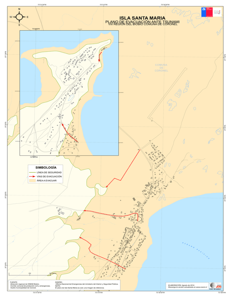
73°31'30"W ² 73°31'0"W 73°30'30"W ISLA SANTA MARIA PLANO DE EVACUACIÓN ANTE TSUNAMI VIII REGIÓN DEL BIOBÍO COMUNA DE CORONEL 73°32'0"W 73°32'0"W 73°31'40"W 36°58'20"S 37°1'30"S 37°1'30"S 36°58'20"S COMUNA DE CORONEL 36°58'40"S 37°2'0"S 37°2'0"S 36°58'40"S 36°59'0"S 36°59'0"S 73°32'0"W 73°32'0"W 73°31'40"W SIMBOLOGÍA LÍNEA DE SEGURIDAD VÍAS DE EVACUACIÓN 37°2'30"S 37°2'30"S ÁREA A EVACUAR O C É A N O P A C Í F I C 37°3'0"S 37°3'0"S O 0 250 500 Metros FUENTE: -Dirección regional de ONEMI Biobío. -Comite comunal de protección civil y emergencias. -Ilustre municipalidad de Coronel. 73°31'30"W DISEÑO: -Oficina Nacional de Emergencias del ministerio del Interior y Seguridad Pública. NOTA: El plano de Isla Santa Maria es solo una imagen de referencia. 73°31'0"W ELABORACIÓN: Agosto de 2014. Descarga la versión actualizada en www.onemi.cl 73°30'30"W COD: 081408047 73°30'0"W
