The quaternary glaciation of Chile: a review
Anuncio
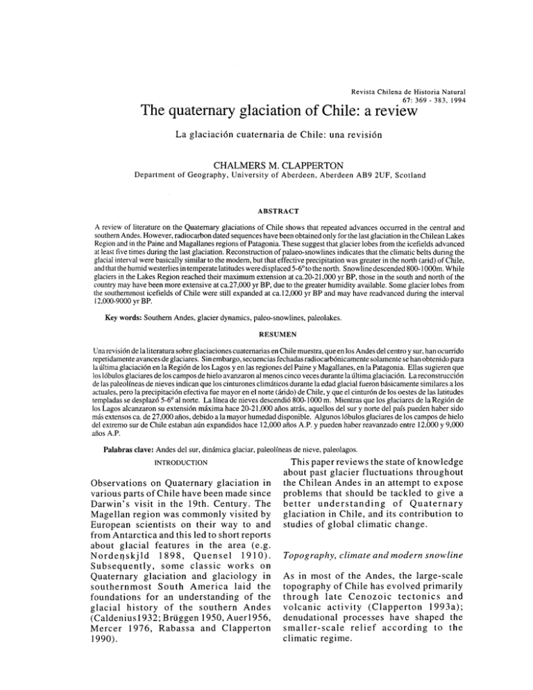
Revista Chilena de Historia Natural 67: 369 - 383, 1994 The quaternary glaciation of Chile: a review La glaciaci6n cuaternaria de Chile: una revision CHALMERS M. CLAPPERTON Department of Geography, University of Aberdeen, Aberdeen AB9 2UF, Scotland ABSTRACT A review of literature on the Quaternary glaciations of Chile shows that repeated advances occurred in the central and southern Andes. However, radiocarbon dated sequences have been obtained only for the last glaciation in the Chilean Lakes Region and in the Paine and Magallanes regions of Patagonia. These suggest that glacier lobes from the icefields advanced at least five times during the last glaciation. Reconstruction of palaeo-snowlines indicates that the climatic belts during the glacial interval were basically similar to the modem, but that effective precipitation was greater in the north (arid) of Chile, and that the humid westerlies in temperate latitudes were displaced 5-6° to the north. Snow line descended 800-1 OOOm. While glaciers in the Lakes Region reached their maximum extension at ca.20-21,000 yr BP, those in the south and north of the country may have been more extensive at ca.27,000 yr BP, due to the greater humidity available. Some glacier lobes from the southemmost icefields of Chile were still expanded at ca.l2,000 yr BP and may have readvanced during the interval I 2,000-9000 yr BP. Key words: Southern Andes, glacier dynamics, paleo-snowlines, paleolakes. RESUMEN Una revision de la literatura sob re glaciaciones cuaternarias en Chile muestra, que en Ios Andes del centro y sur, han ocurrido repetidamente avances de glaciares. Sin embargo, secuencias fechadas radiocarbonicamente solamente se han obtenido para la ultima glaciacion en la Region de Ios Lagos yen !as regiones del Paine y Magallanes, en la Patagonia. Ellas sugieren que Ios lobulos glaciares de Ios campos de hielo avanzaron a! menos cinco veces durante la ultima glaciacion. La reconstruccion de !as paleolfneas de nieves indican que Ios cinturones climaticos durante la ectad glacial fueron basicamente similares a Ios actuales, pero la precipitacion efectiva fue mayor en el norte (ári do) de Chile, y que cl cinturon de Ios oestes de !as latitudes templadas se desplazo 5-6° a! norte. La lfnea de nieves descendio 800-1000 m. Mientras que Ios glaciares de la Region de Ios Lagos alcanzaron su extension maxima hace 20-21,000 años atras, aquellos del sur y norte del pafs pueden haber sido más extensos ea. de 27,000 afios, debido a la mayor humedad disponible. Algunos lobulos glaciares de Ios campos de hielo del extremo sur de Chile estaban aún expandidos hace 12,000 afios A.P. y pueden haber reavanzado entre 12,000 y 9,000 afios A.P. Palabras clave: Andes del sur, dinamica glaciar, paleolfneas de nieve, paleolagos. INTRODUCTION Observations on Quaternary glaciation in various parts of Chile have been made since Darwin's visit in the 19th. Century. The Magellan region was commonly visited by European scientists on their way to and from Antarctica and this led to short reports about glacial features in the area (e.g. Nordeqskjld 1898, Quensel 1910). Subsequently, some classic works on Quaternary glaciation and glaciology in southernmost South America laid the foundations for an understanding of the glacial history of the southern Andes (Caldenius1932; Briiggen 1950, Auer1956, Mercer 1976, Rabassa and Clapperton 1990). This paper reviews the state of knowledge about past glacier fluctuations throughout the Chilean Andes in an attempt to expose problems that should be tackled to give a better understanding of Quaternary glaciation in Chile, and its contribution to studies of global climatic change. Topography, climate and modern snowline As in most of the Andes, the large-scale topography of Chile has evolved primarily through late Cenozoic tectonics and volcanic activity (Clapperton 1993a); denudational processes have shaped the smaller-scale relief according to the climatic regime. 370 CLAPPERTON Extending approximately north-south across latitudes ca.l7°S-56°S, some 4200km, the Chilean Andes contain a number of different tectonic segments with distinctive topography. For example, between latitudes l8°S and 27°S Quaternary-Recent volcanism has created the highest relief, with more than 40 mountains rising above 5500m altitude (Fig.l a); but the mean topographic elevation is ca.4000m. South of Nevada Ojos del Salado (6893m) at latitude 27°S, the Andes are devoid of active volcanoes until latitude 33° 27'S. Nevertheless, underplating of the continental edge by a buoyant part of the N azca ocean crus tal plate has raised this segment of the Andes above a mean altitude of 4000m, culminating in Cerro Aconcagua (6960m). Volcanic massifs appear again at latitude 33°S, where Volcan Tupungatito (5628m) and Volcan Maipo (5264m) are two of the highest, but a dramatic change in topographic elevation occurs at latitude 37°S, south of which only Cerro Valentin (4058m) at latitude c.46°50' S rises above 4000m, and fewer than ten summits exceed 3000m. Here, thinner crust and the subduction regime have created a segment of highly fractured terrain with abundant volcanism; but the mean altitude of the Andean crest is only ca.l800m. Many volcanic peaks rise above 2000m, as in Volcan Villarica (2940m) and Volcan Osorno (2660m), both of which support small icecaps (Fig.lb). South of latitude 4 7°S, the volcanic systems are more widely spaced but the mean topographic elevation rises to ea. 2500m and much of this is covered with the Patagonian icefields (Fig.l c). The climate of the Chilean Andes varies from hyper-arid tropical in the north (lat.l rS-27°S) to hyper-humid temperate at latitu.de ca.50°S. The precipitation regime clearly controls local and regional snowline altitudes and determines the distribution of modern glaciers. Fig. 2 illustrates the annual precipitation characteristics for stations in different climatic regions of Chile and Fig. 3 shows the dramatic fall in snowline altitude from ca.6000m in the north to ca.250m in the south. This is due to the effect of the three primary climatic systems affecting Chile. In the south (lats.56°S-42°S) the constantly wet westerly system, with only slight changes in precipitation amount seasonally, brings totals in excess of 5000mm to sea level stations (Miller 1976). Such high annual precipitation explains the presence of large icefields in southern Chile, with outlet glaciers descending to sea level (Fig. le). Between 42°S-31 os lat., in the so-called 'Mediterranean-type' climatic zone, winter precipitation is brought by the seasonal movement northwards of the Polar Front and associated cyclonic depressions. This nourishes glaciers and snowfields where altitude, topography and exposure provide suitable accumulation sites in these latitudes; but many parts of the mountains even above 4000m altitude lose their snow cover in summer because of high insolation and the relatively low total of mean annual precipitation (250mm). North of latitude ca.32°S mean annual precipitation falls below 300mm, and comes mainly in the austral winter as occasional outbursts from cyclonic storms extend northwards. Some precipitation may come to this part of the Chilean Andes in the austral summer if convectional storms on the Puno-Altiplano extend westwards (invierno boliviano), but the annual amount from this source is generally insignificant. In this region, dominated by anticyclonic atmospheric circulation, intense radiation and evaporation combined with low precipitation totals cause the permanent snowline to lie above 6000m. Thus even where mountains rise above the mean level of the atmospheric 0°C isotherm, commonly at ea. 4900-4700m in these latitudes (Fox 1993), permanent snow and ice can not survive because of aridity and high insolation. Even the highest massif, which rises to 6893m in Nevada Ojos del Salado, has a patchy distribution of permanent snow, and glaciers no longer exist. Moreover, although the summit of Llullaillaco volcano culminates above 6700m, it has no glaciers and supports only a small permanent snowpatch (Messerli et al. 1993). Not only does the snowline altitude rise from east to west in these 371 THE QUATERNARY GLACIATION OF CHILE ... .. , ,.. ,.. .,. FiR. l.a Fig. lb ARGENTINA PATAGONIA ATLANTIC OCEAN ,. .. , ... L_______J00km Fig. l.c Fig. 1: General topography of the Chilean Andes and location of places mentioned in the text. Topograffa general de Ios Andes de Chile y ubicaci6n de Ios lugares mencionados en el texto 372 CLAPPERTON 400 SP A 400 350 350 300 300 .."' 250 "' ::: ~ ~ 11.) u ::i 11.) 11.) 200 Ev 150 100 50 0 ::i B 250 200 150 100 '/ ,_ .... , ------PA JFMAMJJASOND 50 0 JFMAMJJASOND Fig. 2: Mean monthly precipitation for selected stations representing the different climatic regions of Chile (after Miller, 1976). A. Stations south of 45°S: EV: Evangelistas (52°24'S, 75°06'W) B. Stations north of 45°S: Val: Valdivia (39°48'S, 73°14'W) SP: San Pedro (47°43'S, 74°55'W) PA: Punta Arenas (53°10'S, 70°54'W) PM: Puerto Montt (41°28'S, 72°57'W) CON: Concepci6n (36°40'S, 73°03'W) VAL: Valparafso (33°01'S, 71°38'W) LS: La Serena (29°54'S, 71°15'W) Precipitaciones medias mensuales de estaciones seleccionadas como representativas de diferentes regiones climticas de Chile (de acuerdo a Miller, 1976). A. Estaciones al sur de 45"S: SP: San Pedro (47"43'S, 74"55'W) EV: Evangelistas (52"24'S. 75"06'W) PA: Punta Arenas (53"10'S, 70"54'W) PM: Puerto Montt (41"28'S, 72"57'W) B.Estaciones al norte de 45"S: VAL: Valdivia (39"48'S, 73"14'W) CON: Concepci6n (36"40'S, 73"03'W) latitudes, but a clear gradient rises also from north to south between latitudes 30°S and 35°S; a 'snowline' does not exist here since even summits exceeding 6500m are ice-free (Fig.3). Glaciers are largely absent in the Chilean Andes north of 33°S due to increasing aridity, although some small ice fields are present ,locally as far north as 30°S on massifs exceeding 5000m, as on Cerro Doiia Ana and Cerro del Volcan. Farther south, higher seasonal (westerly) precipitation permits substantial icefields and valley glaciers where summits are above ca.4000m, and these were recorded systematically for the first time by Lliboutry (1956). South of lat.37°S, where the Andean crest is almost 2000m lower, glaciers exist only on summits exceeding 2500m until the region of humid westerlies at ca.Iat.45°S. South of here, myriads of glaciers are scattered throughout the Chilean cordillera, including the North and South Patagonian Icefields and extensive icefields on Isla Santa Ines and in the Cordillera Darwin of Isla Gran de de Tierra del Fuego (Fig.lc). All of the modern icefields were more extensive during the late Quaternary, while icecaps and valley glaciers formed over wide areas that no longer contain permanent snow. The quaternary icefields of Chile There are few published papers reporting detailed morphological and chronological 373 THE QUATERNARY GLACIATION OF HCILE evidence of Quaternary glacier extent in the northern and central Andes of Chile, whereas a considerable literature exists on the glaciation of southern Chile. Thus the following sections review the nature of the published data using a regional approach, dealing in turn with the northern, central and southern parts of the Chilean Andes. i. The Northern Andes of Chile: Briiggen (l950,p.212) referred to glacial features on Volcano Toconce at lat.22°S, and considered that Pleistocene glaciers had descended to 3900m when the snowline dropped to 5000m; this was a remarkable discovery for such a hyper-arid area. Supporting observations were made subsequently by Hollingworth and Guest (1967) in a brief description of moraines on the flanks of Volcano Toconce and adjacent volcanoes between Linzor and Height Ojos del Salado (km) 7 ~ Tatio geysers (lats.22°10'-22°2l 'S). They noted that one of the most extensive moraines terminates at about 4280m and considered it to be of Quaternary age. The most recent work on Quaternary glaciation in northern Chile has been by Grosjean et al. (1991), Messerli et al.,(1993) and Fox (1993). Fox (1993) estimated the modern and late Pleistocene snow line altitudes of the Central Andes (5-28°S) on the basis of glacial features (cirques and moraines) interpreted from satellite imagery. This study concluded that in the latitude of northernmost Chile (l7-20°S), the modern snow line rises from ca.5200m in the eastern cordillera of Bolivia to 5600m in the Chilean Andes. At latitudes 23-2rS, snowline rises steeply east to west across the Andes from 5200-6000m (Fig.4) in the Aconcagua 4_ Tupungato. 6 5 4 3 2 •s 200 300 400 so• Fig. 3: Schematic representation of the average topography along the Chilean Andes from 18°-51 os, and an estimate of the modern glacial Equilibrium Line Altitude (thick line). Based on Fox ( 1993 ), Messerli et al.(1993) and Lliboutry (1956). Representaci6n esquemtica de la topografia media a lo largo de Ios Andes chile nos de 18x a 51 xS, y una estimaci6n de la Altitud de la Linea de Equilibrio de Ios glaciares en la actualidad (linea gruesa). Basado en Fox (1993), Messerl1 et al. ( 1993) y Lliboutry (1956). 374 CLAPPERTON 69'W Lowest late ~ s Ple_;J"'o"ne .nowh~ 52-- I ] 67'W 68'W 4 66'W :ikm 2 ~ c 0 u > ® ~ .lj a ·c 69"W 20' 4 < .- .,., 0 0 :! ; ~u u• I 26°· 27°5 f1g. 66'W 68'W 0 0 uu . c ., c 0 ;;; _, 0 0 ~ u u 0: 0 -+A & B: L'umatc' olmoJcrn anJ late Pleistocene snowline gradients across W-E transects in the Central Andes at latitudes 24-25°5 and 26-27°5 (after Fox 1993). Estimaci6n de gradientes de lineas de nieves actuates y del Pleistoceno tardfo a travs de transectos W-E en Ios Andes Centrales alas latitudes 24-25xS y 26-27xS (de acuerdo a Fox 1993). region of maximum aridity. Since the altitude of the mean annual ooc isotherm is at ca.4400m over the southern AltiplanoPuna, the snow line lies 1000-1500m higher. This means that although the topography is high enough to support glaciers, there is inadequate precipitation. From the mean altitude of 5665 reconstructed glaciers on the southern Altiplano and Puna region, Fox ( 1993) estimated late Pleistocene snowline altitudes of ca.3800m in the east and 44004600m in the west at latitudes 17-20°S; at latitudes 23-27°S, the snowline gradient was much steeper, rising east-west from 3800-5200m (Fig.4). These data indicate that the tropical easterly atmospheric circulation dominated the climate of these latitudes during the late Quaternary, as now. This contradicts the conclusion of Hastenrath ( 1971) that the late Pleistocene 30' 40"-.Jf/. so· 9o· w so· 7o· Fig. 4C: Estimate of snow line altitude along the Andes (after Foxl993). The thick arrows indicate precipitation-bearing winds which affect the Chilean Andes. Estimaci6n de !as altitudes de la linea de nieves a lo largo de Ios Andes (de acuerdo a Fox 1993). Las flechas gruesas indican Ios vientos que traen las precipitaciones que afectan Ios Andes chilenos. snowline was depressed more in the west than in the east, from which he inferred a northward migration of the moist westerlies from 29°S (modern limit) to 25°S. Fox's results imply a late Quaternary snowline depression in the arid Andes of northern Chile of ca.800m and he inferred that glaciers reached their maximal extent in this region when precipitation was 75% 375 THE QUATERNARY GLACIATION OF HCILE less than now. This conclusion is remarkable since it implies the development of large glaciers with a mean annual precipitation of only ea. 70mm, and in view of strong insolation and evaporation at such latitudes, the validity of such a view is doubtful. This amount of precipitation decrease may well have occurred at the height of the last global glaciation maximum when arid conditions prevailed in many parts of tropical and sub-tropical South America (Clapperton 1993b), but is unlikely to have coincided with the maximal extent of glaciation in the Altiplano-Puna region. Grosjean et al. (1991) and Messerli et al.(1993) mapped glacial and periglacial (geocryogenic) features and palaeolake shorelines in the Chilean Andes immediately northeast and east of Salar de 7000 Atacama (Fig.l). Here, even the highest mountain, Volcan Llullaillaco (6739m), has only a permanent firn patch under the present climate. This region appears to have been too dry during the last global glaciation maximum for extensive glaciers and palaeolakes, but may have been affected by extreme geocryogenic conditions. It appears that late Quaternary glaciers nourished by westerly precipitation developed only as far north as the latitude of La Serena (30°S). Radiocarbon and thermoluminescence dating of palaeolake sediments suggests that precipitation increased during the lateglacial interval17.000-15.000 yr BP when a shallow lake 5-lOm higher than the modern one developed in the Laguna Leija basin (23°4 7' S; 4300m alt.). Although temperatures were still low, these higher West East Ceno Cordillera delosAndes 6500 A...._,a (69S9) Ceno Iuacal 6000 (6180) RIO ACONCAGUA DRAINAGE 5500 RIOMENDOZA DRAINAGE 5000 g .]., < 4500 Jaciation) ELA(tastg - - - - 4000 ~ell-------- 3500 UtpdMa (1150) ........... 3000 ~ ;~ 2500 2000 1500 40 30 20 10 0 ~ (m5) - (l5QO) 10 20 Distance (km) 30 40 50 RioO>Iomdo (2300) 60 Fig. 5: Transect across the Andes around latitude 33°S showing the glacial limits mapped along the Rio Mendoza in Argentina and the Rio Aconcagua in Chile (after Caviedesl972 and Espizual993). Transecto a traves de Ios Andes cerea de la latitud 33°S mostrando Ios limites de Ios glaciares mapeados a lo largo de Ios cursos de Ios rios Mendoza en Argentina y Aconcagua en Chile (de acuerdo a Caviedes 1972 y Espizua 1993). 70 376 CLAPPERTON lake levels imply mean annual precipitation of ca.300-400mm, which is 60-70% higher than the modern value. A further increase in precipitation occurred after ca.IS.OOO yr BP, and warmer conditions prevailed. The level of Laguna Leija rose 25m above its modern surface, implying an increase in effective precipitation of ca.120% (Messerli et al. 1993,p.122). In the adjacent cordillera glacial moraines extend to 4200m near Tatio geysers, but have not been dated. Nevertheless, Messerli et al. (1993) assigned them to the lateglacial interval of increased precipitation and inferred that the snowline had descended to ca.4650m, indicating a depression of approximately 1350m below the modern value. The validity of this conclusion depends on the age of the moraines, however, and they could be much older. An alternative interpretation is that they formed during a cold but humid interval prior to the last global glaciation maximum. A key observation by Messerli et al.( 1993) is that the moraine limit rises from 4300m at 22°S to 4900m at 25°S and that moraines are absent from Ojos del Salado at 28°S. This pattern suggests that late Quaternary precipitation was brought to the Andes of northern Chile by the southward shift of an intensified tropical summer rainfall pattern from a northerly to northeasterly source, probably with double the modern annual cloud cover. ii. The Central Andes of Chile: This section of the Andes corresponds to the volcanically inactive segment characterised by wide areas above 4000m altitude. It lies between latitudes 30°-33°S and contains many summits above 5000m; Cerro Aconcagua (6960m) is the highest. Precipitation totals rise north to south from ca.200-300mm to over 1 OOOmm in the Aconcagua area as the influence of winter cyclonic circulation increases. Glacial features in the area are widespread ..: .... VI 0 u ..: ...J w 0 ..: lr w ...J ...J Llanquihue (undif) Llanquihue Ill ,..,. 111"1 Llanquihue 11 "!rT " " Llanquihue I T"TT TT Santa Moria ..--rRio Llico -v--r Caracol (buried) Glacier ice 0 0 20km Fig. 6: Limit of Quaternary glacial deposits around Lago Llanquihue in the Chilean lakes region, according to Porter (1981 ). Limite de Ios dep6sitos glaciales del Cuaternario alrededor del Lago Llanquihue en la Region de Ios Lagos de Chile, de acuerdo a Porter (1981 ). THE QUATERNARY GLACIATION OF CHILE Fig. 7: Glacial deposits of late Quaternary advances to the west of Lago Llanquihue (near Puerto Varas). Dep6sitos glaciales de avances del Cuaternario tardfo en el oeste del Lago Lanquihue (cerea de Puerto Varas). compared to the region immediately north, and have been described by Brtiggen ( 1950), Borde (1966), Santana (1967), Paskoff (1970), Caviedes (1972) and Caviedes and Paskoff (1975). The latter study combined observations made along two transects into the mountains, in the Rio Elqui basin (ca.30°S) and in the Rio Aconcagua basin (ca.33°S), and is the most informative. The only modern glacier in the Rio Elqui basin is on the summit of Cerro El Tapado (5124m), where the modern snowline is estimated to lie at ca.5000-5500m. Greater precipitation in the Rio Aconcagua basin nourishes glaciers that descend in places to 3400m where the snow line lies at ea. 4300m (Lliboutry, 1956). In the Elqui basin (Fig.1), the limits of two distinct glacial stages were identified at 31 OOm and 2500m altitude, the lower being more weathered than the upper. In the Rio Aconcagua basin, at least three major moraine stages exist, at 2800m, 1600m and 1300m altitude, each lower one showing a greater degree of weathering. Table 1 illustrates the correlation and inferrred ages for moraines in the central Andes of Chile. These data suggest that glacier expansions in this part of the Andes were associated with a marked increase in precipitation, possibly caused by an equatorward shift by 5-6°lat. of the austral polar front. A more recent study of moraines in the Rio Mendoza valley (Argentina) on the 377 eastern side of Cerro Aconcagua has provided an interesting correlation with the Caviedes-Paskoff scheme (Espizua 1993). Five Quaternary moraine limits were identified (Fig.5), the oldest of which formed before the deposition of a tephra dated to ca.360.000 yr BP. This, the U spallata glaciation, shows that a trunk glacier flowed 80km from Cerro Aconcagua to terminate at 1850m altitude. Assuming the mountains have not risen or lowered substantially ( tectonically) since this glacial stage, a snow line lowering of ca.l430m is implied. The other three stages, the Horcones (2750m), the Penitentes (2500m) and the Punta de Vacas (2350m) were estimated to indicate snowline lowering of ca.l 000, 1200 and 1250m respectively (Espizua 1993; p.l61). Comparing the moraine stages either side of the divide in the central Andes, it is clear that the snowline gradients in the second half of the Quaternary have always sloped upwards from west to east, reflecting precipitation supply from the westerlies. Age determinations on the Penitentes drift using 230Thf2 32 Th and U-series techniques suggest that this glaciation occurred sometime before 40.000 yr BP, but it is not closely dated. The Horcones drift was assigned a latest Pleistocene age because it is composed of relatively unweathered till and has fresh morphology, while the Almacenes moraine farther upvalley is believed to date from the late-glacial interval14.00010.000 yr BP. iii. The Southern Andes From 33-37°S much of the Andean crest lies above 4.000m and was glaciated extensively during the Quaternary, judging from the erosional forms evident on topographical maps. Even where the mean altitude of the Andean cordillera drops dramatically to ca.2000m south of ca.37°S, much of the range was glaciated during Quaternary cold intervals since it lies in a zone of comparatively high precipitation. However, very little information is available on the glacial sequence of this region, possibly due to the effect of very active Quaternary-Holocene volcanism. Thus it is not until the Region de Ios Lagos (Lakes Region) is reached at 378 CLAPPERTON latitude 39°S that published studies of Quaternary glacial sequences are available. The abrupt beginning of a remarkable series of glacially-deepened lake basins on either side of the Andes at this latitude is striking and demands an explanation (Fig.1); yet no one has addressed the issue. Presumably they relate in some way to a zone of high glacial-age precipitation periodically nourishing Quaternary icecaps with erosive outlet glaciers descending to the softer sedimentary strata of the Central Valley. The most informative papers published on the Quaternary glacial sequence of the Chilean Lakes region are those by Briiggen (1950), Weischet (1958,1964), Olivares (1967), Lauer (1968), Laugenie (1971), Mercer (1976), Porter (1981) and Heusser ( 1990). Rabassa and Clapperton ( 1990) and Clapperton ( 1993a) have provided comprehensive overviews. The climate of this region is currently dominated by the seasonal migration northwards in winter of the austral Polar Front, which largely accounts for mean annual precipitation totals of ca.30004000mm in the mountains. Despite abundant precipitation, the low terrain and generally mild temperatures inhibit the development of ice caps and modern glaciers are confined to mountains rising above 2500m (commonly Quaternary volcanoes). It has been estimated that the snowline in this region lies at ca.2200m in the north and possibly as low as 1800m in the south (Rabassa et al. 1980). The largest icefields cap the summits of volcanic massifs such as Lonquimay (2822m), Llaima (3214m), Villarica (2840m), Lanin (3776m), Osorno (2661 m) and Tronador (3554m), but there may be as many as 1000 small glaciers scattered along the Andean t N -, ~ ...... p I n m nz: Moraine system Ice contact face Gullied drift limit Early last Qlaciallon Late last Qlaciation Late last Qlaclatlan c14kaBP? c 12ka BP lr c 12-9 ka BP 'lZI Holocene 8· 5 Radiocarbon dates (KaBP) 0 20km Fig. 8: Schematic map showing the distribution of last glaciation moraine limits in the Cordillera del Paine area at the southeast margin of the Hielo Patagonico Sur (South Patagonian Icefield), according to Marden (1994). Mapa esquematico mostrando la distribuci6n de Ios If mites de las morrenas de la ultima glaciaci6n en al area de Cordillera del Paine en el margen sureste del Hielo Patag6nico Sur (de acuerdo a Marden 1994). THE QUATERNARY GLACIATION OF CHILE Fig. <J: Tephra from Volcan Reclus (white bed) dated to ca.l2.000 yr BP. It overlies a thin bed of peat which covers glaciolacustrine sediments deposited in a lake formed by a lateglacial readvance of ice in Magellan Strait. Tefra del V. Reclus (capa blanca) datada en ea. de 12.000 afios A.P .. Sobreyace a una delgada capa de turba y esta cubierta por sedimentos glacio-lacustres depositados en un !ago originado por un reavance tardiglacial del hielo en el Estrecho de Magallanes. crest of Chile and Argentina (Rabassa 1981). The large morainal arcs surrounding the Chilean lakes have been described in papers referred to above, but the most detailed study of their chronology is still that by Porter (1981). Working around and to the west of Lago Llanquihue, Porter separated the glacial deposits into mappable 'drift units' which were described at type sections and assigned a local nomenclature. On the basis of relative weathering studies, four separate drift sheets were distinguished, each representing a full glaciation. The youngest drift, known as the 'Llanquihue drift', forms morainal arcs around the margin ofLago Llanquihue and components of it have been radiocarbon dated to the last glaciation. The other three drifts, extending up to 40km farther west, have no age control but are presumed to represent glacier expansions since the early-mid Quaternary (Fig.6). The Llanquihue drift was subdivided into three components of different age (Mercerl976, Porterl981) and named Llanquihue I,II and Ill, oldest to youngest. Since the Llanquihue I drift is older than 379 the range of conventional radiocarbon dating, but is relatively fresh in appearance, Mercer (1983) considered it could have been deposited during marine isotope stage 4 (MIS4); Porter (1981) was more cautious and did not r-ule out a penultimate glaciation age for this unit. Llanquihue II drift is better constrained with radiocarbon dates. Outwash gravels overlain by Llanquihue II till contains peat clasts as young as 20,100 +1-500 yr BP (Mercer 1976) and this indicates the advance culminated after ca.20.000 yr ago. Recession of the Llanquihue II glacier is believed to have occurred just before 18,900 +1-370 yr ago, since this is the age of basal peat in a meltwater spillway that functioned when the glacier lay at its drift limit. Thus Porter (1981) concluded the Llanquihue II glaciation occurred at 20.000-19.000 yr ago, corresponding closely to the global glaciation maximum, a view supported by Heusser ( 1991) based on evidence from Isla de Chiloe farther south. Llanquihue Ill drift seems to have been deposited by a readvance of the Llanquihue glacier following an interval of recession (the "Varas interstade" of Mercer 1976) when it withdrew almost to the eastern end of the Lago Llanquihue basin. There is no end moraine, but interpretation of glaciolacustrine deposits and radiocarbon dating led Porter ( 1981) to infer that readvances had culminated about 15.000-14,500 yr ago and after ca.l3,145 yr ago. Support for a readvance during this late-glacial interval came from Dalcahue on Isla de Chiloe, where an organic bed buried by till inside the limit of a subdued Llanquihue Ill (equivalent) moraine yielded radiocarbon ages in the range 15,600-14,300 yr BP (Mercer 1984 ); this suggests a readvance culminated just before ca.14.000 yr BP. At the time of writing, detailed investigations of the drift sequences around Lago Llanquihue, Lago Rupanco and Lago Puyehue are yielding new results (Denton 1993). It is clear that the moraine sequence is much more complex than originally believed and that it may indicate repeated advances of outlet glaciers from the Lakes Region icecap to similar limits during the last glaciation (Fig.7). 380 CLAP PER TON Porter (1981) estimated that a snowline depression of ca.1 OOOm must have occurred for an outlet glacier to reach the western side of the Llanquihue lake basin. Recent modelling experiments have suggested that the conterminous icecap over this part of the Andes could not be generated by temperature depression alone and that a substantial increase in mean annual precipitation must also have occurred (Hulton et al. 1994). iv. The Chilean Channels and FuegoPatagonia: South of latitude 46°S the climate is dominated by wet maritime westerly air chilled in its passage across the Humboldt Current. Although there is seasonal movement north and south of the zone of intense precipitation, much of the west coast of Chile south of latitude 46°S is wet and windy all year round. This explains the presence of two substantial icefields centred on relatively low (ca.2000m) topography in temperate latitudes, the Hie- Fig. I 0: Schematic diagram showing the present and last glaciation snowline altitudes throughout various latitudes of the Andes. Diagrama esquematico mostrando !as alturas de la linea de nieves en la actualidad y durante la ultima glaciaci6n a traves de Ios Andes a varias latitudes. lo Patagonico N orte (HPN) and Hielo Patagonico Sur (HPS). Moreover, a multitude of smaller icecaps and glacier systems are scattered throughout this zone wherever the topography is high enough, as on Is la Santa Ines and Cordillera Darwin, where glaciers descend to sea level. The Equilibrium Line Altitudes of glaciers in this region range between 500m in the west and 1350m in the east (Kerr and Sugden in press). Very little is known about the extent of Quaternary glaciation in the Chilean Channels region and it has commonly been assumed that the expanded Patagonian icefields terminated on the continental shelf west of the land masses (Caldenius 1932, Denton and Hughes 1981). However, recent palaeoecological studies in the area suggest that land refugia for some plants and flightless beetles possibly existed on Isla Wellington during the last glaciation (Ashworth et a1.1991). This has important implications for reconstructions of glacialage climate in the region as it suggests a rather restricted ice extent when the global ice volume was at its highest. Farther south, large moraine systems extend eastwards from the southern margin of the HPS and from the former icecap centred on Isla Desolacion, Isla Santa Ines and Cordillera Darwin. The moraines were mapped by Caldenius ( 1932) who believed that most of them represent late stages of the last glaciation. Studies of glacial deposits in Argentina by Mercer (1976) demonstrated that the most extensive Patagonian glaciation occurred about one million years ago. Meanwhile, paleomagnetic data from glacial sediments around Lago Buenos Aires (Lago General Carrera) have shown that the system of five complex moraine belts represent Pliocene and Quaternary glaciations (Clapperton 1983; Morner and Sylwan 1989). Similarly, the stacked drifts composing the peninsulas in Magellan Strait, viz. Segunda Angostura, Primera Angostura and Punta Dungeness (Fig.1), may represent a long history of late Cenozoic glaciation. The sequence of glacial advances during the last glaciation in this region of Chile has now been mapped in detail in two places, around Torres del Paine and in THE QUATERNARY GLACIATION OF CHILE Magellan Strait. In the Lago Sarmiento basin adjacent to the Paine massif (Fig.8) four major moraines may be associated with advances of the last glaciation (Marden 1994). The easternmost (Stage P, Fig.8) is composed of deformed lacustrine sediments and could represent the initial 'clear-out' of the lake basin during an early stage of the last glaciation. The next two are similar in form and weathering characteristics and may mark limits reached during a later stage of the last glaciation, prior to the global glaciation maximum, but there is no dating control. The fourth moraine is older than a tephra dated to 12.000 yr BP and is morphological very fresh. While it would 'fit' with the Llanquihue Ill stage of the Lakes Region in terms of relative position, its precise age is not known. Younger moraines and drift limits (IV and V on Fig.8) are late-glacial in age. The easternmost, situated some 20km from the modern icefront, indicates a stillstand during deglaciation and must have occurred just before ca.12.000 yr BP. This is known from the reworked pumice clasts forming uppermost layers of the outwash, the pumice having travelled through the glacier system from the accumulation zone close to Reclus volcano (Fig.l c). Geochemical analyses and radiocarbon dating have established that this volcano had a large eruption at ca.l2.000 yr BP (R.McCulloch, personal communication 1993). Recession from this stillstand limit was followed by a readvances to form a moraine complex sometime before 8.700 yr BP, the minimal radiocarbon age of basal peat in a kettle basin immediately inside the end moraine. The palaeoclimatic significance of these data is that deglaciation after the last glacial maximum in this area was not rapid. Moreover, moraine complex V (Fig.8) may well have been deposited by an readvance of Grey glacier responding to a climatic perturbation induced by theY ounger Dry as stadia! event of the North Atlantic (Clapperton 1993c) particularly if the icefield was already in a relatively expanded position. Marden ( 1994) has explained these differences between Paine and sites farther north in terms of migrations of the belt of high precipitation. 381 Preliminary data on the late Quaternary glacial sequence in Magellan Stait suggests that Magellan glacier advanced along the strait at least five times during the last glaciation, the last occasion occuring after 12.000 yr BP. Following the last glaciation maximum, Magellan glacier probably withdrew rapidly southwards due to rapid ablation through calving in a proglacial lake 200-SOOm deep (Porter et a1.1992). The glacier possibly remained at topographic pinning points in the southern part of Magellan Strait (as at Paso del Hambre) between ca.14.000-12.000 yr BP before advancing into deposits containing Reclus tephra (Fig.9) dated to ca.l2.000 yr BP (R.McCulloch, personal communication 1993). This advance may have produced a renewed rise in proglacial lake level that cut impressive shorelines near Porvenir and on the northern tip oflsla Dawson (Fig.lc). In conjunction with evidence emerging from the Chilean Lakes region for repeated advances of these climatically-sensitive glacier systems during the last glaciation, the Paine and Magellan sequences suggest responses to the global climatic fluctuations during MIS3 and MIS2 implied by the ice core records DISCUSSION Know ledge of the succession of Quaternary glacier fluctuations in Chile is important for understanding the nature of climatic changes throughout almost 40 degrees of latitude in the Southern Hemisphere. This review of existing data about such fluctuations ratses the following conclusions 1. The overall pattern of climatic belts affecting Chile remained essentially similar to the modern one, as indicated by the palaeo-snow line gradients (Fig.l 0). These imply that precipitation decreased from east to west in northern Chile and from west to east in central and southern Chile, as now. 2. Although the climatic pattern was similar, there were substantial changes in temperature and effective precipitation, and in the location of westerly rain belts. For example, in the semi-arid northern Andes, 382 CLAPPERTON the presumed lowering of mean annual temperature during Quaternary glacial intervals must have been accompanied by an increase in effective mean annual moisture, otherwise glaciers clould not have formed. Similarly, extensive icefields could not have built up in the Chilean lakes region without a significant rise in precipitation. Moreover, Quaternary icefields would probably have been more extensive in southern Chile if precipitation had been as high as the modern total. 3. Increased effective precipitation in northern Chile during glacial intervals may have resulted from greater cloudiness and lower evaporation induced by a cooler atmosphere. Higher precipitation in the lakes region may have resulted from a northerly migration of the zone of greatest westerly humidity, due to a weaker Pacific anticyclonic system and an expanded subAntarctic cover of sea ice. 4. The estimated snowline depression of 800-1 OOOm for late Quaternary glacial intervals in Chile may not indicate that the atmosphere cooled by as much as 5-6.5°C (assuming a 0.65°Cil OOm lapse rate), since higher precipitation in some regions would have had a significant effect in lowering the snow line. An overall cooling by at least 4 °C seems likely, but could have been more or less at different sites, where local influences such as exposure to katabatic winds were probably important. 5. The apparent rise in the glacial snow line towards latitude 28-30°S from both northern and southern directions suggests that this currently hyper-arid region remained as dry during glacial intervals, despite the (assumed) lowering of atmospheric temperature. This implies that the seasonal westerlies failed to penetrate or migrate more than about 2 degrees of latitude farther north than their modern limit, and that the humid (tropical) easterlies did not expand much farther south than their current (seasonal) extent. Wider Implications Evidence emerging from radiocarbon-dated glacial sequences in the Llanquihue and Magellan areas suggests that icefield outlet glaciers advanced to similar limits several times during the last glaciation. As new ice core data from Greenland and marine core data from the North Atlantic imply atmospheric fluctuations of a quasi-cyclical nature throughout the last glaciation (Bond et al., 1993 ), the Chilean icefields may also have responded in a similar fashion, assuming high sensitivity to variations in temperature and precipitation. The validity of such correlation awaits detailed glacial chronologies from the various glaciated regions of Chile. The nature and age of glacier fluctuations in northern and north-central parts of Chile remain poorly known and require detailed investigation. This is an important task to undertake since it is vital to compare palaeoclimatic records between subtropical arid and temperate humid regions to understand the precise nature of global climatic changes during the late Quaternary. ACKNOWLEDGMENTS I am most grateful to Dra.Carolina Villagran and colleagues of the University of Chile for inviting me to participate in the symposium in Santiago and to CONICYT for financial support. Thanks are due also to the Natural Environment Research Council of Britain for supporting fieldwork in Chile over the past three years with Research Grant GR3/7637. THE QUATERNARY GLACIATION OF CHILE LITERATURE CITED ASHWORTH AC, V MARKGRAF,and C VILLAGRAN ( 1991) Late Quaternary history of the Chilean channels based on fossil pollen and beetle analyses, with an analysis of modern Yegetation and pollen rain. Journal of Quaternary Science,6 (4):279 291. AUER V (1956) The Pleistocene of Fuego-Patagonia. Part I. The Ice and Interglacial Ages. Annales Academiae Scientiarum Fennicae,Ser.A., 50: 1-239. BOND G,W BROECKER, S JOHSEN, J MCMANUS, L LAB EYRIE, J JOUZEL, & G.BONANI. ( 1993) Correlations between climate records from North Atlantic sediments and Greenland ice. Nature, 365:143 147. BORDE J (1966) Les Andes de Santiago et leaur avantpays, etude de geomorphologie. Bordeaux. , BROGGEN, J. 1950 Fundamentos de la geolog1a de Chile. Instituto Geognifico Militar,Santiago de Chile. CALDENIUS CC. ( 1932) Las glaciaciones cuaternarias en la Patagonia y Tierra del Fuego. Geografiska Annaler,l4: 1-64. CA VIEDES 0 ( 1972) Geomorfologia del Cuaternario en el Valle del Aconcagua. Freiburger Geographische Schriften, Hefte 11. CAVIEDES 0 and R PASKOFF ( 1975) Quaternary glaciations in the Andes of north-central Chile. Journal of Glaciology,70: 155-170. CLAPPERTON CM (1983) The glaciation of the Andes.Quaternary Science Reviews,2: 85-155. CLAPPERTON CM (1993a) Quaternary Geology and Geomorphology of South America. Elsevier, Amsterdam: 779pp. CLAPPERTON CM (1993b) Nature of environmental changes in South America at the last glacial maximum. Palaeogeography, Palaeoclimatology ,Palaeoecolo gy 101: 189-208. DENTON GH. (1993) Chronology of late Pleistocene glaciation near Lago Llanquihue between Puerto Varas and Puerto Octay. In, Villagran,C. (Ed.):El Cuaternario de la Region de Los Lagos del Sur de Chile. (Taller Internacional "El Cuaternario de Chile",Santiago,1-9 Nov.I993:Guia de Excursion). Capitulo 2 53-63. DENTONGHandHUGHES,T.J. (1981) TheLastGreat Ice Sheets. Wiley-Interscience, New York. ESPIZUA L (1993) Quaternary glaciations in the Rio Mendoza valley, Argentine Andes. Quaternary Research,40 (2):150-162. FOX A (1993) Snowline altitude and climate in the Central Andes (5-28°S) at present and during the late Pleistocene glacial maximum. PhD Dissertation, Cornell University,USA. GROSJEAN M ( 1992) Zur Klimatologie und PaHiookologie des nordchilenischen Altiplano seit dem letzten Kaltzeitmaximum. Geographisches Institut Bern: Ill pp. HASTENRA TH S ( 1971) On the Pleistocene snow-line depression in the arid regions of the South American Andes. Journal of Glaciology, 10: 255-267. HEUSSER CJ (1990) Chilotan piedmont glacier in the Southern Andes during the last glaciation maximum. Revista Geolol6gica de Chile,l7: 3-18. KERR A. and SUGDEN,D.E. (1994) The sensitivity of the SouthChilean snowline to climatic change. Climatic Change (in press). 383 HOLLINGWORTH S and J GUEST (1967) Pleistocene glaciation in the Atacama Desert,northern Chile. Journal of Glaciology,6 (4):749-751. HULTON N, DE SUGDEN, and CM CLAPPERTON ( 1994) Glaciermodelling and the climate of Patagonia during the last glacial maximum. Quaternary Research (in press). LAUER W (1968) Die glaziallandschaft des Si.idchilenischen Seengebietes. Acta Geographica (Helsinki),20 (16):215-236. LAUGENIE JC. ( 1971) Elementos de la cronologia glaciar en Ios Andes Chilenos meridionales. Cuadernos Geognificos del Sur. (Santiago de Chile), 1: 7-20. LLIBOUTRY L (1956) Nieves y Glaciares de Chile: Fundamentosde Glaciologia. Ediciones de la Univ.de Chile. Santiago. MARDEN CJ ( 1994) Late Quaternary glacial history of theSouth Patagonian Icefield at Torres del Paine. Unpublished PhD Thesis, University of Aberdeen, Scotland. MERCER JH (1976) Glacial history of southernmost South America. Quaternary Research,6: 125-166. MERCER JH ( 1983) Cenozoic glaciation in the Southern Hemisphere. Ann.Rev.Earth Planet.Sci., 11:99-132. MERCER JH ( 1984) Late Cainozoic glacier vanatwn m South America south of the Equator. In: J.C.Vogel (Ed.), LateCainozoic Palaeoclimates of the Southern Hemisphere.Balkema, Rotterdam,pp.45-58. MESSERLI B, M GROSJEAN, G BONANI. et al. (1993) Climate change and natural resource dynamics of the Atacama Altiplano during the last 18.000 years: a preliminary synthesis. Mountain Research and Development,l3 (2): 117-127. MILLER A (1976) The climate of Chile. In: W.Schwerdtfeger (Ed.): World Survey of Climatology: Vol.l2. Climates of Central and South America. Elsevier, Amsterdam: 113-145. MORNER N-A. and C SYLWAN (1989) Magnetostratigraphy of the Patagonian moraine sequence at La go Buenos Aires. J .South American Earth SCiences, 2: 385-390. NORDENSKJOLD 0 (1898) Tertiary and Quaternary deposits in the Magellan territories. American Geologist,21:300-309. . OLIV ARES PB ( 1967) Las glaciaciones cuaternanas al Oeste del Lago Llanquihue en el sur de Chile. Revista Geografica. 67: 100-108. PORTER SC ( 1981) Pleistocene glaciation in the southern Lake District of Chile. Quaternary Research, 16:263292. PORTER SC, CM CLAPPERTON, and DE SUGDEN ( 1992) Chronology and dynamics of of deglaciation along and near the Strait of Magellan, southernmost South America. Sveriges Geologiska Undersoknmg, Ser.Ca.81: 233-239. QUENSEL PD (1910) On the influence of the Ice Age on the continental watershed of Patagoma. Bull.Geol.Inst.Univ. Upsala (Sweden),No.9. SANT AN A R ( 1967) Rasgos de la glaciaci6n cuaternaria en El Manzanar. Valle de Cachapoal. Andesde Rancagua. Revista Geografica de Valparaiso,1 (I): 85-98. WEISCHET W (1964) Geomorfologia glacial de la region de Los Lagos. Communicaciones de la Escuela de Geologia,No.4,Universidad de Chile,Santiago: 36pp.
