Unit 20 Nuestro mundo (Our world)
Anuncio
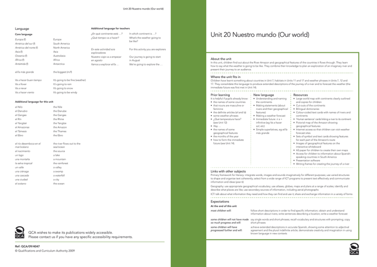
Unit 20 Nuestro mundo (Our world) Language Additional language for teachers Core language ¿En qué continente está …? Europa (f) Europe América del sur (f) South America ¿Qué tiempo va a hacer?What’s the weather going to be like? América del norte (f) North America Asia (f) Asia Oceania (f) Australasia África (f) In which continent is …? En este actividad sois exploradores For this activity you are explorers Africa Nuestro viaje va a empezar en agosto Our journey is going to start in August Antártida (f) Antarctica Vamos a explorar el/la … We’re going to explore the … el/la más grande the biggest (m/f) Va a hacer buen tiempoIt’s going to be fine (weather) Va a llover It‘s going to rain Va a nevar It’s going to snow Va a hacer viento It’s going to be windy Additional language for this unit Unit 20 Nuestro mundo (Our world) About the unit In this unit, children find out about the River Amazon and geographical features of the countries it flows through. They learn how to say what the weather is going to be like. They combine their knowledge to plan an exploration of an imaginary river and present their journey to an audience. Where the unit fits in Children have learnt something about countries in Unit 7, habitats in Units 11 and 17 and weather phrases in Units 7, 12 and 17. They consolidate this language to produce extended descriptions of the journey of a river and to forecast the weather (the immediate future was first met in Unit 14). Prior learning New language Resources It is helpful if pupils already know: • the names of some countries • that nouns are masculine or feminine • the definite articles (el and la) • some weather phrases • ¿Qué temperatura hace? (see Unit 12) • Hay … • the names of some geographical features • the months of the year • how to form the immediate future (see Unit 14). • Understanding and naming the continents • Making statements (about rivers and their geographical features) • Making a weather forecast • Immediate future: ir a + infinitive (eg Va a hacer sol, etc) • Simple superlatives, eg el/la más grande • Large world map with continents clearly outlined and copies for children • Cut-outs of the continents • Bilingual dictionaries • Colour-coded text cards with names of rivers and continents • ‘Human sentence’ cards linking a river to its continent • Pictorial map of the Amazon showing geographical features • Internet access so that children can visit weather forecast sites • Sets of symbol and text cards showing features for each part of the Amazon’s route • Images of geographical features on the interactive whiteboard • A3 paper for children to create their own maps • Access for children to information about Spanishspeaking countries in South America • Presentation software • Writing frames for creating the journey of a river el Nilo the Nile el Danubio the Danube el Ganges the Ganges el Rin the Rhine el Yangtsé the Yangtze el Amazonas the Amazon el Támesis the Thames el Ebro the Ebro el río desemboca en el mar/océano the river flows out to the sea/ocean el nacimiento the source un lago a lake una montaña a mountain la selva tropical the rainforest un valle a valley una ciénaga a swamp Links with other subjects una cascada a waterfall una ciudad a city el océano the ocean Primary framework for literacy: integrate words, images and sounds imaginatively for different purposes; use varied structures to shape and organise text coherently; select from a wide range of ICT programs to present text effectively and communicate information and ideas (year 6) Geography: use appropriate geographical vocabulary; use atlases, globes, maps and plans at a range of scales; identify and describe what places are like; use secondary sources of information, including aerial photographs ICT: talk about what information they need and how they can find and use it; share and exchange information in a variety of forms Expectations At the end of this unit most children will: follow short descriptions in order to find specific information; obtain and understand information about rivers; write sentences describing a location; write a weather forecast some children will not have made say single words and short phrases; recall vocabulary and structures with prompting; copy so much progress and will: short phrases QCA wishes to make its publications widely accessible. Please contact us if you have any specific accessibility requirements. Ref: QCA/09/4047 © Qualifications and Curriculum Authority 2009 some children will have progressed further and will: achieve extended descriptions in accurate Spanish, showing some attention to adjectival agreement and the plural indefinite article; demonstrate creativity and imagination in using known language in new contexts Unit 20 Nuestro mundo (Our world) Learning objectives Possible teaching activities Children should learn Learning outcomes Points to note Children Section 1. Crossing continents • to recognise patterns in the foreign language (KAL) • to make predictions based on existing knowledge (LLS) • Display a world map where continents are clearly outlined. Point to each continent and introduce its name, eg Europa (Europe), África (Africa), América del sur (South America), América del norte (North America), Asia (Asia), Oceanía (Australasia), Antártida (Antarctica). Repeat names quickly/slowly/loudly/quietly to practise pronunciation. • Display outline shapes of each continent. Ask the class to look at the world map and see if they can identify the individual shape of each continent. Encourage children to give answers in Spanish. Divide the class into two teams to play Tocad el dibujo (Touch the Picture). One child from each team comes to the front. Call out a continent and the first child to touch the correct outline wins a point for their team. • Before displaying the names of each continent on the board, give children the opportunity to have a go at writing them independently. Display the words on the board. How accurate were children’s first attempts at spelling these words? Discuss similarities and differences in pronunciation between English and Spanish, eg América, África, Asia. • Explain to children that much of the focus of this unit will be on rivers of the world. Can they name any in English? Display the names of a selection of rivers (see ‘Points to note’) and model pronunciation. Children repeat. Explain the notion of gender for ‘named’ rivers. What clue would children be looking for? Remind children that the definite article (el/la) shows the gender and that the o or a ending alone can sometimes be misleading, eg el Amazonas. • As it is unlikely that your set of bilingual dictionaries contains the names of rivers, ask children to research the gender of some of the continents so that they can practise checking for gender in a dictionary (see ‘Points to note’). • Extension: Challenge the class to see how many continents and rivers they can recall in Spanish. • Extension: Children label a map of the world, writing the names of the continents from memory. • Extension: Challenge the class to see how many continents and countries they can remember in Spanish. Invite them to predict how many they will be able to recall. • Extension: Children label a map of the world with the continents and known countries. They can do this on the interactive whiteboard and print out the completed screen. • recall and say the names of continents with good pronunciation • understand the notion of gender for proper nouns such as rivers and continents • • Suggested rivers: el Nilo el Danubio el Ganges el Rin el Yangtsé el Amazonas el Támesis el Ebro Fifth activity: Bilingual dictionaries for children do not always contain all seven continents. It might be advisable to check which continents feature in your class dictionaries before this activity. • Follow-up: Throughout the week, give children the opportunity to identify and name the continents in Spanish. • Follow-up: Use satellite-imaging software to view continents. • Allow children time to explore the courses of some of the rivers mentioned in this section. • Revise names of rivers and continents from the last section and play a simple matching game by writing a selection of the rivers on the left-hand side of the board and continents on the right. Call out the name of a river and ask the question, for example, ¿En qué continente está el Amazonas? to elicit América del sur. • Display the sentence El Amazonas está en América del sur (The Amazon is in South America) and read aloud. Ensure that children are clear about the meaning. Display the answer to another question, eg ¿En qué continente está el Támesis? and the class chorus El Támesis está en Europa. • Invite a few children to come to the front to make a human sentence using large individual word cards, eg El Ganges está en Asia. Ask volunteers to read the sentence aloud. Continue building human sentences with different rivers and continents. Alternatively, children continue this activity by building sentences with word cards in pairs or small groups. • Play Pelmanism. Write the names of rivers and continents on individual cards. You will need to ensure that there are enough ‘continent cards’ for each river. Colour-code the cards, eg blue for rivers and green for continents. Place the cards face down on the board. The first child comes to the board and turns over a river card and a continent card. The class build a sentence using the two cards, eg El Nilo está en Europa. If the river and continent do not match, the cards are replaced. If they do match, the child keeps the cards. Continue the game until all the pairs have been found. Confident children may prefer to build the sentence without the support of the whole class. • Give pairs of children a copy of a map of the world where the continents are clearly outlined. Provide them with a list of the rivers and continents and ask them to label each continent, eg El Yangtsé está en Asia. Encourage pairs to share their maps with another pair. • Extension: Provide children with a list of different rivers, one for each continent. Children research the location of each river and label each continent accordingly. • say which continent a river is in • label rivers and continents on a map • Follow-up: Throughout the week, play Pelmanism, matching rivers with continents. • Follow-up: Throughout the week, give pairs / small groups of children word cards with which to build sentences about rivers and continents. • Follow-up: Throughout the week, encourage confident children to take the role of the teacher and ask the class, for example, ¿En qué continente está el Rin? Section 2. Rivers and continents • to match sound to sentences and paragraphs (L6.3) • to write sentences on a range of topics using a model (L6.4) • to use knowledge of word and text conventions to build sentences and short texts (KAL) Continued over Unit 20 Nuestro mundo (Our world) Learning objectives Possible teaching activities Children should learn Learning outcomes Points to note Children Section 3. Language detectives • to understand longer and more complex phrases or sentences (O6.3) • to match sound to sentences and paragraphs (L6.3) • to use knowledge of word order and sentence construction to support the understanding of written text (KAL) • to notice and match agreements (KAL) • Explain to children that they are going to be looking at a text about rivers. Display the text and read it aloud (see ‘Points to note’ for the text). Stop at various points and ask children to point out where you are in the text. • Ask children to name the main river featured in the text. Invite a child to come to the board to underline the name (it occurs twice in the text). • Show children the text for El Guadalquivir (see ‘Points to note’). Point out to them that in Spanish the pronoun for ‘it’ is not used, so for example tiene means ‘it has’. • Show children the headings in the facts table below and ask if they can work out their meaning (the English is given here for your information). You may prefer to use extracts from the text, eg tiene … de largo (It is ... long) or desemboca en … (It flows into ...), rather than the headings provided. • read and understand the main points in a non-fiction text • use detail from a text to complete a chart • use a simple superlative to describe a river • Here is the text for the first activity: Los ríos del mundo (Rivers of the world) Cada continente tiene un río grande. En Europa está el Rin. En África está el Nilo y en América del sur está el Amazonas. El Amazonas es el segundo río más largo y más ancho del mundo. Tiene 6,400 kilómetros de largo. Su nacimiento está en Perú, en las montañas de los Andes. Pasa por las ciudades de Iquitos en Perú y Manaus y Belem do Pará en Brasil. Por fin desemboca en el océano Atlántico cerca de Marajó en Brasil. (Each continent has a large river. In Europe there’s the Rhine, in Africa there’s the Nile and in South America there’s the Amazon. The Amazon is the second-longest and the widest river in the world. It’s 6,400km long. Its source is in Peru in the Andes mountains. It flows through the cities of Iquitos in Peru and Manaus and Belem do Pará in Brazil. It finally flows into the Atlantic ocean near Marajó in Brazil.) Nombre del río (Name of the river) La longitud (Length) El nacimiento (Source) La desembocadura (Mouth of the river) Ciudades principales (Main towns) • Here is the text for the third activity: El Guadalquivir (The Guadalquivir) El Guadalquivir es un río muy importante en España. Tiene 657 kilómetros de largo. Su nacimiento está en la Sierra de Cazorla y desemboca en el océano Atlántico cerca de Cádiz. Pasa por las ciudades de Córdoba y Sevilla. (The Guadalquivir is a very important river in Spain. It is 657km long. It starts in the Sierra de Cazorla (mountain range) and flows out into the Atlantic Ocean near Cadiz. It runs through Córdoba and Seville.) Otros detalles (Other information) • Children work in pairs to complete the facts table about the Amazon. They feed back their answers and check them together as a class. Discuss which strategies children used to locate the information. • Extension: Using information about El Ebro, children complete an additional facts table. • Display and read the sentence El Amazonas es el segundo río más largo del mundo. In pairs, children briefly discuss its meaning. Show the sentence Londres es la ciudad más grande de Europa and ask children to read it aloud and work out its meaning. Display a world map where the continents are clearly outlined and ask ¿Cuál es el continente más grande? in order to elicit Asia. Write the following sentence on the board and ask the class to join in as you read it aloud: Asia es el continente más grande. • Extension activity: Give children some key words, eg el Nilo, África and el río and ask them to build sentences, which they read aloud to a partner. • You may wish to ask a native speaker to provide a recording of these two texts. • Follow-up: Cut the text into sentence strips. In pairs or small groups, children sequence the text. • Follow-up: Throughout the week, Play Repetid si es verdad (Repeat if it’s True) with key facts about the continents and/or rivers, eg En África está el Amazonas. Europa es el continente más grande del mundo. El Ebro pasa por Londres. • Follow-up: Give children the opportunity to research rivers in Spain or a Spanish-speaking country. Children share their information with the class. Continued over Unit 20 Nuestro mundo (Our world) Learning objectives Possible teaching activities Children should learn Learning outcomes Points to note Children Section 4. What is the weather going to be like? • to use spoken language confidently to initiate and sustain conversations and to tell stories (O6.4) • to read and understand the main points and some detail from a short written passage (L6.1) • to recognise patterns in the foreign language (KAL) • to use a dictionary (LLS) • Re-read the first text from Section 3. Ask children to close their eyes and imagine the scenery at three different stages of the river’s journey (you may wish to refer to the technical terms ‘upper’, ‘middle’ and ‘lower’). Ask for suggestions (in English) as to the type of landscape they would expect to see, and repeat these in Spanish. The children might suggest, for example, a lake (un lago), a mountain (una montaña), the rainforest (la selva tropical), a desert (un desierto), a valley (un valle), a swamp (una ciénaga), a waterfall (una cascada), a town (una ciudad), the sea (el mar), the ocean (el océano). For the purpose of this unit, children will also need to know los altiplanos (high plateaux). • Display a pictorial map of the Amazon’s journey, with concealed symbols showing some of the geographical features. Ask children to suggest what type of landscape they would expect to see in different places. Reveal the symbols if they match the children’s suggestions and say Sí, hay montañas aquí, etc. Encourage children to repeat each of the new vocabulary items after you. • Reveal all the symbols if you have not already done so, and practise pronunciation of the vocabulary. Play a quick game to reinforce this (see the Teachers’ guide for ideas). • Read out the journey of the Amazon to the children (see ‘Points to note’), pointing out the different features. Take the opportunity to point out that some of the nouns are plural. Ask children how they could identify this without seeing the written text (by hearing the words los or las). What do children remember about making simple plurals in Spanish? Display the written words on the board and discuss. • Explain to children that they are explorers who will be leading a team to explore the Amazon: En esta actividad sois exploradores (For this activity, you are explorers). They will need to compile and send out a document to the rest of their team, explaining what they will encounter. Part of the information that will be needed for the journey is a weather forecast. • Revise weather phrases in the present tense (Units 7, 12 and 17), eg hace calor, and show children how this sentence changes to Va a hacer calor (It will be hot) if forecasting the weather. Display both sentences together and encourage children to discuss the differences in pairs. They may like to make comparisons with English. • Show children another example, eg Hace buen tiempo, and how to change this if forecasting the weather. Challenge children to change the phrases Hace mal tiempo and Hace frío as if they were forecasting the weather. Check that they understand the meaning of these phrases. Tell them that the only exceptions to this pattern are Va a llover (It‘s going to rain), Va a nevar (It’s going to snow) and Va a hacer viento (It’s going to be windy), and write all the new phrases in the future tense on the board. • Introduce the question ¿Qué tiempo va a hacer? Display different weather symbols and as you point to them children chorus the appropriate phrase. • Extension: Challenge the class to see how many continents, landscape features and weather forecast phrases they can remember in Spanish. Invite them to predict how many they will be able to recall. Will it be 10? Or more? • understand and say some weather phrases in the immediate future tense • recognise and pronounce some geographical features • The notion of the upper and lower courses, where a river begins in the mountains or hills and flows down to the sea, could be explained in Spanish using simple language to explain how a river reaches the sea: Normalmente, el nacimiento de un río está en las montañas. El río pasa por los valles de abajo. El río desemboca finalmente en el mar. (Normally, the source of a river is in the mountains. The river flows down through the valleys. Finally it flows out into the sea.) • There are some very good websites that can be used for the weather activity, which show the weather across the world and how it is moving across the continents. With these sites you can also look at temperatures, which are either shown using colour charts (from blue for very cold to dark red for very hot) or are shown in figures. • Follow-up: Children make labelled weather forecast cards for display in the classroom or hall. • Follow-up: Throughout the week, children look up the daily weather forecast in a particular continent. This can be done using a newspaper to find out about the weather in five selected cities across the continent. They collate the information in a bar chart. • Follow-up: Throughout the week, children post a daily weather report in the main entrance. This should contain yesterday’s weather, the weather today and a forecast for tomorrow. • Follow-up: If the school has a partner school in a Spanish-speaking country, make a comparison of weather conditions. Continued over Unit 20 Nuestro mundo (Our world) Learning objectives Possible teaching activities Children should learn Learning outcomes Points to note Children Section 5. The journey of the Amazon • to understand longer and more complex phrases or sentences (O6.3) • to recognise and understand some of the differences between people (IU6.2) • to use language known in one context or topic in another context or topic (LLS) • Revise the question ¿Qué tiempo va a hacer? and answers. • Show children the pictorial map of the Amazon. Remind them that they are explorers leading a team to explore the river: En esta actividad sois exploradores. The journey is going to take five months and they will need to explain to other members of their imaginary team what they will see each month and what the weather is going to be like. • Children work in groups. Give each group copies of symbol cards showing the correct features for each part of the journey (the full text describing each part of the journey can be found at the end of the unit). On each card there will be a variety of symbols, eg the outline and name of Peru, a mountain and someone shivering. Explain that these show what they will encounter each month on their journey and choose one of the symbol cards to talk through, eg El nacimiento del Amazonas está en las montañas de Perú. En agosto, en las montañas va hacer frío. (The source of the Amazon is in the mountains of Peru. In August, in the mountains, it’s going to be cold.) Give out the text cards (see ‘Points to note’) and ask children to match the text cards with the symbol cards and put them in the correct order. • Children read their texts aloud to each other, focusing on pronunciation. Encourage children to comment constructively on each other’s reading. As a class, establish the correct order of the text cards. • Extension: Children research the countries that the Amazon crosses on its journey. Children can formulate geographical questions, eg ‘What is the landscape like?’, ‘Which languages are spoken?’ • understand and use the preposition en + country or continent • read and understand a short text in the present and future tenses • Text cards for the third activity: a. El nacimiento del Amazonas está en las montañas de Perú. En agosto, en las montañas va hacer frío. (The source of the Amazon is in the mountains of Peru. It will be cold in the mountains in August.) b. El Amazonas pasa por los valles y las selvas tropicales de Perú y Brasil. En septiembre, en las selvas tropicales va a llover. (The Amazon flows through the valleys and rainforests of Peru and Brazil. In September, in the rainforests, it is going to rain.) c. El Amazonas pasa por las cascadas de la selva Pongos en los altiplanos. En octubre, en los altiplanos, va a hacer viento. (The Amazon flows through the waterfalls of the Pongos Jungle on the high plateaux. In October, on the high plateaux, it is going to be windy.) d. El Amazonas pasa por las ciudades de Iquitos en Perú y Manaus y Belem do Pará en Brasil. En noviembre, en las ciudades va hacer sol. (The Amazon flows through the cities of Iquitos in Peru and Manaus and Belem do Pará in Brazil. In November it will be sunny in the towns.) e. El Amazonas pasa por las ciénagas en Brasil. En diciembre, en las ciénagas va a hacer calor. Por fin desemboca en el océano Atlántico. (The Amazon flows through swamps in Brazil. In December, it is going to be hot in the swamps. Finally it flows into the Atlantic Ocean.) • Follow-up: Invite individual children to the board to add labels for the source, the different countries, the landscape features, etc. • Follow-up: Throughout the week, children answer the register with a sentence containing en + continent, eg Estoy en Asia. • Play the Human Sentence game with a number of sentences, eg El Nilo está en África, El Amazonas pasa por las selvas tropicales. Cut each sentence up into separate words and challenge groups of children to reorder the words correctly. Ask each group to read their sentence aloud before putting the sentences on the board. • Tell children that they are going to use this lesson to plan their own exploration of an imaginary river. This can be done as a poster for display or made into an oral presentation. Remind them that, for each part of the journey, their team will need information on geographical features and what the weather will be like. You may wish to display the pictorial map of the Amazon with labelled features as a reminder. • As a class, write the first paragraph about an imaginary river together: Nuestro viaje va a empezar en agosto. Vamos a explorar el/la + name of river. El/la … está en + continent. El/la … es el río más largo de + continent. El/la … tiene … kilómetros de largo. El nacimiento del / de la … está en + geographical feature. El/la … pasa por + geographical feature. En agosto, en + geographical feature va a + weather. • Extension: Point out that in the class paragraph, when de is followed by el it becomes del. • Children work in pairs, using the model above to scaffold their writing. Some children may need to work from an individual writing frame based on the model above. Remind children that their journey should: – last several months – include a variety of different landscapes – include a variety of weather conditions. • Throughout the session, ask children to read out their work in progress. • Write the final sentence together as a class, eg Por fin desemboca en el océano … • produce a non-fiction text for display/ presentation • apply language to a new context • In order to differentiate the river journey activity, you might ask some children to create a journey that only lasts two or three months, instead of five. Alternatively, you might prefer to provide a writing frame or gap-fill text for those children who need extra support. • Follow-up: Throughout the week, children can continue their preparation of the information text. • Follow-up: Children transfer their paragraphs onto their own A3 pictorial maps of their imaginary rivers, or onto presentation software. Section 6. Explorers • to write sentences on a range of topics using a model (L6.4) • to use knowledge of word and text conventions to build sentences and short texts (KAL) • to apply a range of linguistic knowledge to create simple, written production (LLS) Continued over Unit 20 Nuestro mundo (Our world) Learning objectives Possible teaching activities Children should learn Learning outcomes Points to note Children End-of-unit activity • to apply the knowledge, skills and understanding in this unit • Children present their river journeys to a friendly audience, to their own or another class or during a school assembly. • present information in a variety of ways • Follow-up: If children have made posters, make these into a classroom display. • If the school has a Spanish-speaking partner school, the class could email photos of their presentations or present their work via a videoconferencing link. El Amazonas (full text) The Amazon (full text) Nuestro viaje va a empezar en agosto. Vamos a explorar el Amazonas. El Amazonas es el segundo río más largo del mundo aparte del Nilo, y es el río más ancho del mundo. Tiene 4,600 kilómetros de longitud. El nacimiento del Amazonas está en las montañas de Perú. En agosto, en las montañas va a hacer frío. Our exploration is going to start in August. We are going to explore the Amazon. The Amazon is the second-longest river in the world after the Nile and is the widest river in the world. It is 4,600 kilometres long. The source of the Amazon is in the mountains of Peru. In August in the mountains it’s going to be cold. El Amazonas pasa por los valles y las selvas tropicales de Perú y Brasil. En septiembre, en las selvas tropicales va a llover. The Amazon flows through the valleys and the rainforests of Peru and Brazil. In September in the rainforests it’s going to rain. El Amazonas pasa por las cascadas de la selva Pongos en los altiplanos. En octubre, en los altiplanos, va a hacer viento. The Amazon flows through the waterfalls of the Pongos Jungle on the high plateaux. In October on the high plateaux it’s going to be windy. El Amazonas pasa por las ciudades de Iquitos en Perú y Manaus y Belem do Pará en Brasil. En noviembre, en las ciudades va hacer sol. The Amazon flows through the cities of Iquitos in Peru and Manaus and Belem do Pará in Brazil. In November in the cities it’s going to be sunny. El Amazonas pasa por las ciénagas en Brasil. En diciembre, en las ciénagas va a hacer calor. Por fin desemboca en el océano Atlántico. The Amazon flows through the swamps in Brazil. In December in the swamps it’s going to be hot. Finally, it flows into the Atlantic Ocean.
