Valparaíso, ciudad Patrimonio de la Humanidad. Tensión
Anuncio
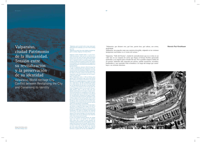
86 dossier Valparaíso, ciudad Patrimonio de la Humanidad. Tensión entre su revitalización y la preservación de su identidad Valparaiso, World Heritage City. Conflict between Revitalising the City and Conserving its Identity Bodegas Simón Bolívar, planta Simón Bolivar Bodegas, layout 87 “Valparaiso, you're so aloof, what a crazy, insane port, dishevelled and windswept, you never finish combing your hair. Valparaiso, so small, like a cloth, helpless, hanging ragged in a window, flapping in the Ocean Wind.1” Valparaiso, literally “Paradise Valley”, is a city of contradictions, because it does not lie in a valley but on a series of hills that reach the Pacific Ocean generating streams and a narrow plain at the edge of the sea. Neither is it possible to talk of it as being a paradise, having been plundered and sacked by pirates, been shaken by earthquakes, fires, bombardments and supported a prolonged economic crisis which has contributed to its growing decline. The Port of Valparaiso, declared a World Heritage Site in 2002, is characterised by the uniqueness of its natural and constructed landscape. Shaped by hills that overlook the sea, its architecture has been made possible thanks to funicular railways and stairways. It has always been a port, which has given the city its identity and its raison d'être. When Independence came in 1810, all Chilean ports opened up to international trade, which had hitherto been limited to the colonies controlled by the Spanish Monarchy; this enabled Valparaiso, a coastal city lying 33º 2´ South and 71º 38´ West, to develop on the basis of its trade relations. By the end of the 19th century the city had become the main port in the South Pacific, owing to its key position as the first port after the Straits of Magellan, which lie to the south. This privileged position, which it held for more than four decades, commenced with the export of wheat to California and Australia as a consequence of the requirements brought about by the “Gold Rush” that affected the two destinations, followed by the export of saltpetre, a mineral that was to be found in abundance in the northern regions of the country, which came to form part of Chile after the Guerra del Pacífico against Peru and Bolivia, which turned Chile into the world's leading exporter of this natural fertiliser and raw material used in the manufacture of gunpowder. The arrival of the railway was one of the most important factors to shape the urban image of the Port of Valparaiso, firmly establishing it in its role as a strategic point for loading and unloading commodities and merchandise. This means of transport was combined with the port activities connecting the city with the capital of the country, Santiago, a city that had established itself as the hub for distribution that linked the north of the country with the south. In view of the adverse physical features, the railway layout was forced to run parallel to the coastline, which meant that it formed a barrier between the inhabitants and the shoreline, which together with the supporting infrastructure and storage facilities gives it its mark of distinction. The railway is a distinctive feature that is now under threat because the industrial port and railway heritage has fallen into a state of dereliction, coupled with the fact that UNESCO's her- “Valparaíso, que distante eres, qué loco, puerto loco, qué cabeza, con cerros, desgreñada. Valparaíso, tan pequeña como una camiseta desvalida, colgando en tus ventanas harapientas meciéndose en el viento del océano.1” Valparaíso, “Valle del Paraíso”, ciudad de contradicciones que no se sitúa en un valle sino en un conjunto de cerros que llegan al Océano Pacífico generando quebradas y un angosto plan al borde del mar. No es posible tampoco hablar de un paraíso, habiendo sido saqueada por piratas, sufrido terremotos, incendios, bombardeos y una sostenida crisis económica a lo largo del tiempo que contribuye a su creciente deterioro. Marcela Pizzi Kirschbaum 88 dossier La singularidad de su paisaje natural y construido, caracteriza el puerto de Valparaíso, ciudad declarada Patrimonio de la Humanidad en el año 2002. Conformada por cerros que miran el mar, poblados por una arquitectura hecha posible por medio de funiculares y escaleras; ciudad que siempre fue puerto, condición que le da sentido, identidad y razón de ser. Con el advenimiento de la Independencia en 1810, se decreta la apertura de los puertos de Chile al comercio internacional, restringido hasta entonces a los dominios de la Corona Española. Ello permite que Valparaíso, ciudad costera ubicada en los 33º2' de latitud sur, 71º38' longitud oeste, se desarrolle a partir de las relaciones comerciales que la sitúan hacia fines de siglo como el principal puerto del Pacífico Sur, debido a su posición, como primer puerto luego del cruce del Estrecho de Magallanes. Dicha condición, que se extiende por más de cuatro décadas, se inicia a partir de la exportación de trigo a California y Australia a raíz de la “fiebre del oro” desatada en ambos destinos, y luego con la exportación de salitre, mineral que se encontraba en los territorios del norte del país incorporados, luego de la Guerra del Pacífico contra Perú y Bolivia, que convierte a Chile en el principal productor mundial de este abono natural y elemento base para la fabricación de pólvora. La llegada del ferrocarril fue uno de los aspectos más relevantes que configuró la imagen urbana del puerto de Valparaíso, consolidando su rol como punto de embarque y llegada de materias primas y mercaderías. Este medio de transporte se conjuga con las actividades portuarias conectando la ciudad con la capital del país, Santiago, urbe que a su vez se constituye como el centro neurálgico de distribución que comunica el norte y sur del país. Por las características topográficas existentes, el trazado de Ferrocarril, debió construirse de manera paralela al bordemar transformándose en una barrera que separa a los habitantes del bordemar, con la construcción de infraestructura de apoyo y almacenamiento que le otorga su particular impronta. Dicho carácter se ve hoy amenazado por el estado de abandono en que este patrimonio industrial portuario y ferroviario se encuentra, a lo que se suma el hecho que la declaratoria como patrimonio de la humanidad por UNESCO excluye parte importante de dicha infraestructura no reconociendo su valor como tal. Urge entonces una ampliación del área de protección que permita la revitalización de la misma y así mantener la identidad que la caracteriza. Como meta para el Bicentenario, se busca generar para la ciudad puerto, una nueva condición, la de “ciudad turística”, cuyo sentido debe buscar el equilibrio con la preservación de su imagen, carácter e identidad histórica, considerando el patrimonio de la ciudad en un sentido más amplio, agregando a la “arquitectura culta”, aquella de tipo industrial y portuaria, patrimonio aún invisible y no debidamente reconocido en nuestro contexto. Identificamos el período de generación de este patrimonio a mediados del siglo XIX, asociado con la construcción del Ferrocarril de Santiago a Valparaíso, finalizado en 1863; a su vez su decadencia comienza a producirse a partir del terremoto de 1906 a lo que se agrega la disminución del tráfico naviero y mercantil producto de la apertura del Canal de Panamá en 1914. Debido a estos hechos, se produce entonces, una crisis económica continua que no ha permitido la revitalización de la ciudad, con propuestas por parte del gobierno para su recuperación. Esta situación de deterioro y estancamiento, como contrapartida, genera un desarrollo más lento de la ciudad que permite que, aún a inicios del siglo XXI, continúe existiendo un patrimonio de características excepcionales que representa valores universales, correspondiente a la expresión de un período de la historia que tuvo repercusiones mundiales que caracteriza la edad moderna y que podemos identificar como la era industrial. Clave es en la definición del carácter de su paisaje tangible, el patrimonio industrial portuario asociado al ferrocarril, paralelo al bordemar y que curiosamente ha quedado fuera del área protegida por UNESCO, en el podemos identificar al menos cinco áreas relevantes: Área 1: Desde Plaza Sotomayor donde se emplaza la Capitanía de Puerto, la Administración de Aduanas y la Comandancia de la Armada. La Estación Puerto actúa como punto de inicio y remate de la línea férrea, conectando el centro cívico con el resto de la ciudad hacia el norte. Espacialmente se constituye como un portal. 89 itage site declaration does not cover an important part of the infrastructure, failing to recognise its value as such. The protected area must be enlarged right away, so that the city can be revitalised and thus conserve the identity that characterises it. A target for the Bicentenary is to create a new status for the port city, that of “tourist city”. However, it is necessary to seek a balance that must involve conserving its image, character and historical identity, considering the city's heritage in a broader sense and context, adding the industrial and port architecture to the “cultured” architecture, because the former is still invisible and not properly recognised in our context. The point in time when this heritage was created can be traced back to midway through the 19th century, and it can be associated with the construction of the railway linking Santiago and Valparaiso, which was completed in 1863; it began to go into decline after the 1906 earthquake, to which was added the decrease in shipping and merchant traffic once the Panama Canal came into operation in 1914. These events led to an ongoing economic crisis that prevented the revitalisation of the city, in spite of the recovery proposals made by the Government. However, this situation of deterioration and stagnation caused the city to develop more slowly, which meant that even at the beginning of the 21st century, the city still has heritage with exceptional qualities that represents universal values, giving expression to a period of history that had major effects upon the world that characterises the modern age and that can be referred to as the industrial age. The industrial heritage of the port associated with the railway is the key factor in defining the character of its tangible landscape. The railway hugs the shoreline but it has curiously been excluded from UNESCO's protected area. We can make a distinction between at least five major areas: Area 1: From the Plaza Sotomayor, where a series of institutions are to be found, namely the Port Authority, the Customs House and the Naval Command Headquarters. The Harbour Station serves as both the starting point and the terminus for the railway line, connecting the civic centre with the rest of the city towards the north. From a spatial perspective it is a gateway. Area 2: From the Plaza Sotomayor heading along the Avenida Errázuriz to the north, towards the Law Faculty at the University of Valparaiso. The Simón Bolívar Bodegas2 are in this area; this building is a large reinforced concrete structure, probably the biggest in South America, lying between two railway stations, Francia and Baron. Part of it has been refurbished to serve as the Cruise Terminal, but the rest of the building faces an uncertain future. It is currently earmarked for demolition, but at present one zone is being used as refrigeration facilities, while another is still a Bodega, run by the company Empresa Portuaria de Valparaiso, EPV. The Muelle Barón3 lies in this area; it was constructed by the English firm Pearson & Sons, Ltda., and is currently being used a venue for major art exhibitions. Area 3: Composed of a set of railway facilities lying opposite Barón Station, such as the Bodega Sudamericana and Agencias Aéreas y Marítimas, SAAM; the former Ordnance Depot (talleres del ferrocarril) and the Turntable, in one single historical building well worth conserving in spite of its advanced state of deterioration. The sector adjacent to the Turntable, houses the former Motive Power Depot belonging to the Automotores de EFE-Empresa de Ferrocarriles del Estado, known as a “Zona Típica”4 in the Municipal Plan in 1986 Area 4: From the Barón Station to the Universidad Técnica Federico Santa María, work of the architects J. Smith Solar and J. Smith Miller in Neo-Gothic style in the tradition of the English Universities, declared “Zona Típica” (Traditional Zone) in 1986. Area 5: Between the Federico Santa María University and the Caleta Portales5, lies the Paseo Wheelwright6. An important milestone where city planning is concerned, was the 1965 Municipal Plan, placing Val- Área 2: Desde la Plaza Sotomayor avanzando por la Avenida Errázuriz hacia el norte, hasta la Facultad de Derecho de la Universidad de Valparaíso. En esta área se ubican las Bodegas Simón Bolívar2, estructura de gran envergadura en hormigón armado que probablemente constituye la más larga de Sudamérica, entre dos estaciones ferroviarias, Francia y Barón. Parte de ella ha sido remodelada para servir de terminal de Cruceros, siendo incierto el destino del resto del edificio, propuesto para demolición, en donde un sector esta concesionado como frigorífico y otro destinado a Bodega de la Empresa Portuaria de Valparaíso, EPV. Se emplaza en esta área el Muelle Barón3, construido por la firma inglesa Pearson & Sons. Ltda., el que actualmente es utilizado para eventos artísticos de carácter masivo. Área 3: Conformado por un conjunto de instalaciones ferroviarias frente a la Estación Barón, tales como la Bodega Sudamericana y Agencias Aéreas y Marítimas, SAAM; la antigua Maestranza y la Tornamesa, único inmueble de conservación histórica pese a su avanzado estado de deterioro. En el sector contiguo a la Tornamesa, se emplaza el antiguo Galpón de los Automotores de EFE, (Empresa de Ferrocarriles del Estado), reconocida como “Zona Típica”4 por el Plan regulador Comunal en 1986. Área 4: Desde la Estación Barón hasta la Universidad Técnica Federico Santa María, obra de los arquitectos J. Smith Solar y J. Smith Miller en estilo neogótico a imagen de las universidades inglesas, declarada “Zona Típica” en 1986. Área 5: Entre la Universidad Federico Santa María y la Caleta Portales5, se desarrolla el Paseo Wheelwright6. Un hito importante en cuanto al ordenamiento territorial representa el Plan Intercomunal de 1965 que sitúa a Valparaíso, como centro gravitante de un área metropolitana más amplia, en que se regula el borde costero y se propone una nueva red vial para conectar las zonas portuarias, industriales y residenciales. Sin embargo las opciones de desarrollo se dificultan al sufrir la ciudad un nuevo terremoto en 1985 que destruye edificios patrimoniales y cuatro sitios de embarque del puerto. De manera más reciente, Valparaíso es incorporada como una de las cuatro ciudades del Plan Bicentenario7; con ello se concesiona el puerto, se construyen autopistas y un tren metropolitano regional. De igual modo se proyectan zonas de esparcimiento en el borde costero inspiradas en Barcelona como modelo. A ello se suma la transformación en paseo del antiguo muelle Barón en 2002; se construye el terminal de cruceros y se autoriza el desarrollo de áreas inmobiliarias en la zona de Barón y Yolanda, que genera un polémico proyecto de Shopping Center de inspiración norteamericana, de la cadena “Mall Plaza”, que ocasiona fuertes protestas de los habitantes. A pesar de las iniciativas mencionadas y de la nominación de UNESCO, la ciudad sigue deteriorándose debido a la situación de pobreza y al relevante porcentaje de desempleo. Si realmente queremos su revitalización debemos generar incentivos que impulsen su desarrollo económico a la vez de aunar criterios en torno a las políticas y acciones con la debida participación ciudadana. Las iniciativas gubernamentales han estado diluidas en numerosos organismos sin autoridad real para la toma de decisiones y una falta de focalización de las inversiones, lo que no ha permitido una revitalización de la ciudad en adecuado equilibrio con su identidad. Bibliografía Consultada Benavides, Juan; Pizzi, Marcela; Valenzuela, María Paz; “Ciudades y Arquitectura Portuaria”, Editorial Universitaria, Santiago, Chile, 1994. BID, “Preparación Programa de Recuperación y Desarrollo Urbano de Valparaíso” Santiago, Chile, 2006. Jiménez Vergara, Cecilia; Ferrada, Mario; “Los Valores Universales del Patrimonio Arquitectónico y Urbano de Valparaíso”, Revista Urbano, Concepción, Chile, septiembre 2003. Gobierno de Chile, Ministerio de Obras Públicas, “Chile 2010: Visión Ciudad Bicentenario”, 2005. Gobierno de Chile, Ministerio de Educación, Consejo de Monumentos Nacionales, “Postulación de Valparaíso como Sitio del Patrimonio Mundial UNESCO”, Segunda Serie nº 70, 1ª Edición, Cuadernos, CMN, Santiago, Chile, 2004. Neruda, Pablo; “Oda a Valparaíso”, en Libro de las Odas, Editorial Losada, 1972 Waisberg, Myriam; “Valparaíso: El Legado Urbanístico y Arquitectónico”, Revista de Arquitectura nº 3, Santiago, Chile, 2000. Archivos Digitales: ARPA, Red de Archivos Patrimoniales de Valparaíso, http://www.arpa.ucv.cl/ Memoria Chilena, http://www.memoriachilena,cl paraiso as the centrepiece of a more extensive metropolitan area; this Plan regulates the coastal strip and proposes a new road network for linking the port, industrial and residential zones. However, the development options were made more complicated after another earthquake in 1985, which destroyed heritage buildings and four port embarkation sites. In more recent times, Valparaiso came to be one of the four cities in the Bicentenary Plan7; this involved granting licences to use the port, constructing motorways and a metropolitan railway line for the region. Along the same lines, leisure and recreation areas have been planned throughout the coastal strip; these take their inspiration from Barcelona and use that city as a model. A further development was to turn the former Barón Wharf into a promenade in 2002; a cruise ship terminal is to be constructed and authorisation has been given to create commercial and shopping areas in the Barón and Yolanda zone, which has led to a controversial, North-American style Shopping Centre project developed by the chain “Mall Plaza”; this has caused an outcry from the local residents. In spite of the aforementioned initiatives and the UNESCO declaration, the city is still deteriorating because of the poverty situation and the relatively high unemployment rate. If what we really want is revitalisation, we must create incentives that enhance economic development while at the same time unifying criteria regarding policies and actions, ensuring that the citizens can participate in the processes involved. The Government initiatives have been weakened by being split into a variety of different bodies with no real decision-making authority and a lack of focus where investments are concerned, which has served as a barrier to a revitalisation of the city in harmony with its identity. Notes 1. Neruda, Pablo; “Ode to Valparaiso”, extracts from the Book of Odes, Editorial Losada, 1972 2. Constructed around 1920, it is 450 metres long. 3. Wharf constructed in 1917, which coped with the unloading of the coal that arrived to supply the first section of the Railway, and the movement of cargos and materials. It mainly supplied the Gas Holder, which was unfortunately dismantled a few years ago. Gas was manufactured there to provide street lighting and gas for homes, but electricity rendered it obsolete. 4. “Zona Típica”: Title VI of the Conservation of Environmental Features Act (Act 17, 288), dating back to 1970, which protects the national monuments referred to in Article 29. By virtue of this legislation coming into effect, and with a view to conserving the environmental qualities of certain cities, towns or places that contained remains of archaeological interest or ruins and buildings declared to be National Monuments, the National Monuments Council could request that the conservation of such sites be declared to be in the public interest, so that the charm and quaintness of these places, or certain zones within them, could be protected for the future. 5. Constructed in 1860 as a Slaughter House associated with an agricultural fair, in 1929 it was refurbished for use by fishermen. 6. Pedestrian precinct created in 2006, which covers a surface area of 1,722 metres. 7. The Bicentenary Plan (2010), seeks “to transform our urban areas into more inhabitable, modern and competitive places for 2010, in such a way that they become genuine places for social and individual development that fulfil a basic role in the integration and coexistence of their inhabitants.” In order to achieve this for Valparaiso, which lies on the most emblematic coastal strip in Chile, the aim is to give it a modern image, free of pollution and obstructions that prevent the population from access to the sea. Government of Chile, Ministry of Public Works, “Chile 2010: Bicentenary City Vision”, 2005. 90 dossier 91 Puerta de Ingreso al puerto de Valparaíso Bodegas Simón Bolívar Gateway to the Port of Valparaiso Simón Bolivar Bodegas Notas 1. Neruda, Pablo; “Oda a Valparaíso”, fragmentos en Libro de las Odas, Editorial Losada, 1972 2. Construida alrededor de 1920 con una longitud de 450 metros. 3. Muelle construido en 1917, que atendía la llegada del carbón para el servicio de la primera sección del Ferrocarril, y el movimiento de carga y materiales. Proveía principalmente al Gasómetro, lamentablemente desmontado en años recientes. Se fabricaba a partir de él gas para alumbrado público y domiciliario, con la energía eléctrica su uso quedó obsoleto. 4. “Zona Típica”: El titulo VI de la Conservación de los Caracteres Ambientales de la Ley nº 17.288, de 1970 que legisla sobre monumentos nacionales indica en su Artículo 29º. Para el efecto de mantener el carácter ambiental y propio de ciertas poblaciones o lugares donde existieren ruinas arqueológicas, o ruinas y edificios declarados Monumentos Históricos, el Consejo de Monumentos Nacionales podrá solicitar se declare de interés público la protección y conservación del aspecto típico y pintoresco de dichas poblaciones o lugares o de determinadas zonas de ellas. 5. Construida en 1860 como Matadero asociado a una feria agrícola, la que a partir de 1929 se habilita como caleta de pescadores. 6. Paseo peatonal creado en 2006, que abarca 1.722 metros. 7. El Plan Bicentenario 2010, busca “transformar nuestras urbes en ciudades más humanas, modernas y competitivas para el 2010, de manera que sean verdaderos espacios de desarrollo, tanto personal como social, y cumplan un rol fundamental en la integración y convivencia de las personas.” Para ello se pretende en el caso de Valparaíso, que se constituya como el borde costero más emblemático de Chile, con un rostro más moderno, descontaminado y libre de obstáculos que impidan la relación entre la población y el mar. Gobierno de Chile, Ministerio de Obras Públicas, “Chile 2010: Visión Ciudad Bicentenario”, 2005.
