dr. john h. kelly - CA Indígena
Anuncio
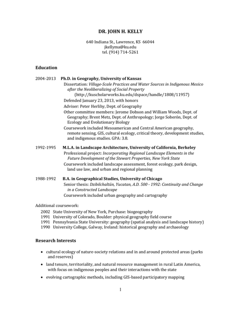
DR. JOHN H. KELLY 640 Indiana St., Lawrence, KS 66044 [email protected] tel. (914) 714-5261 Education 2004-2013 1992-1995 1988-1992 Ph.D. in Geography, University of Kansas Dissertation: Village-Scale Practices and Water Sources in Indigenous Mexico after the Neoliberalizing of Social Property (http://kuscholarworks.ku.edu/dspace/handle/1808/11957) Defended January 23, 2013, with honors Adviser: Peter Herlihy, Dept. of Geography Other committee members: Jerome Dobson and William Woods, Dept. of Geography; Brent Metz, Dept. of Anthropology; Jorge Soberón, Dept. of Ecology and Evolutionary Biology Coursework included Mesoamerican and Central American geography, remote sensing, GIS, cultural ecology, critical theory, development studies, and indigenous studies. GPA: 3.8. M.L.A. in Landscape Architecture, University of California, Berkeley Professional project: Incorporating Regional Landscape Elements in the Future Development of the Stewart Properties, New York State Coursework included landscape assessment, forest ecology, park design, land use law, and urban and regional planning B.A. in Geographical Studies, University of Chicago Senior thesis: Dzibilchaltún, Yucatan, A.D. 500 - 1992: Continuity and Change in a Constructed Landscape Coursework included urban geography and cartography Additional coursework: 2002 State University of New York, Purchase: biogeography 1991 University of Colorado, Boulder: physical geography field course 1991 Pennsylvania State University: geography (spatial analysis and landscape history) 1990 University College, Galway, Ireland: historical geography and archaeology Research Interests • cultural ecology of nature-society relations and in and around protected areas (parks and reserves) • land tenure, territoriality, and natural resource management in rural Latin America, with focus on indigenous peoples and their interactions with the state • evolving cartographic methods, including GIS-based participatory mapping 1 Professional Experience (Teaching) 2014-2015 Adjunct Professor of Geography, Department of Natural and Physical Sciences, Park University, Parkville, Missouri. Created and taught courses “Global Sustainability” (introductory environmental studies/geography), “Geography of Terrorism” (advanced undergraduate political geography), and “Geography of Latin America.” 2013 2013 2012 Visiting Professor, Dirección de Postgrado (Graduate Studies Division), Universidad Pedagógica Nacional Francisco Morazán, Tegucigalpa, Honduras. Created and taught intensive course in concepts and applications of GIS. Lecturer, Department of Geography, University of Kansas. Created and taught course “World Regional Geography,” and co-taught course “Topics in Cultural Geography/Latin American Studies: Indigenous Latin American Peoples and Lands.” Adjunct Professor, Command and General Staff College, Fort Leavenworth, Kansas. Created and taught course “Geography of Mexico: Culture, History, and Political Structure” as part of Southwest Border Scholar’s Program. 2008 taught undergraduate course “Introductory Lab in Physical Geography,” University of Kansas 2006 helped develop seminar for high school teachers (module “Latin Americans in the United States”), Center for Latin American Studies, University of Kansas 2007-2011 taught distance learning courses “Principles of Human Geography” and “Principles of Physical Geography” for University of Kansas Continuing Education Program (KUCE); proposed and enacted significant revisions to both courses 2005 developed and taught undergraduate course “Concepts in Human Geography,” University of Kansas 1994 teaching assistant for course “History of the U.S. Built Environment” at University of California, Berkeley with geographer Paul Groth 1999-2000 developed and taught course (in Spanish) “Introducción al Diseño del Paisaje” [“Introduction to Landscape Design”] at Universidad Autónoma de Yucatán, Mérida, México, with emphasis on incorporating regional indigenous ethnobotanical techniques and geographic concepts into contemporary landscape designs. Served on thesis project defense committee for a student. 1993-1995 organized weekly guest lectures at Department of Landscape Architecture, University of California, Berkeley 2 Professional Experience (Research and Applied Work) 2013-2015 Post-Doctoral Research Fellow, American Geographical Society CA Indígena project team (www.prmapping.res.ku.edu). Duties include: • collaborating with colleagues at the Universidad Pedagógica Nacional Francisco Morazán, Tegucigalpa, Honduras in the supervision and GIS training of three indigenous student researchers • integrating participatory-mapping-derived and other data sets to produce innovative ArcGIS Online “transparent maps,” for use by indigenous groups in Honduran Mosquitia (including MASTA and FITH), to develop the management and governance of protected areas and “concejos territoriales” (multi-village-scale collective tenure properties) • helping to identify variables and analyze data associated with territorial, cultural, and environmental stability in indigenous areas throughout Central America • varied activities in the University of Kansas community, including service as judge at 2014 Graduate Research Competition 2010-2013 geographic researcher with American Geographical Society “Expedition to the Borderlands” project team. Duties included: • creating integrated GIS platform of thirty countries in Central America and the Caribbean, with emphasis on ethnic census data, land tenure systems and dynamics, and protected areas • helping organize the World Human Geography Conference (University of Kansas and Haskell Indian Nations University), with focus on communities and ethics in social science fieldwork • mentoring a master’s degree student in geography 2010-2011 graduate student organization representative at departmental meetings, Department of Geography, University of Kansas; co-organized GIS Day, and served as guest teacher at two local middle schools 2006-2007 student representative for Cultural Ecology Specialty Group, Association of American Geographers 2005-2008 geography researcher with Mexico Indígena international project team (principal institutions: University of Kansas, Universidad Autónoma de San Luis Potosí). Duties included: • conducting community mapping workshops in two fieldwork regions: Huasteca Potosina, San Luis Potosí and Sierra Norte, Oaxaca • training and supervising local investigators and Mexican student researchers • acquiring and analyzing geographic and land tenure data from Mexican institutional sources • diverse GIS tasks using ArcGIS software • development and maintenance of project website, including scalable vector graphics and GoogleEarth web portals for online interactive GIS 3 2003-2004 2003 2002 conducted collaborative fieldwork, community land use planning workshops, GIS database development and training, community map production, and report preparation for Ordenamiento Territorial en Cuatro Comunidades de la Sierra Norte, Oaxaca, Mexico [Rural Land Use Plan in Four Communities of the Sierra Norte, Oaxaca, Mexico], a World Wildlife Fund Oaxaca/CAPLAC, A.C. project in the Chinantec indigenous area researched and mapped proposed boundaries for Área Protegida Comunitaria de Guiengola [Guiengola Community Reserve] for Jardín Etnobotánico de Oaxaca/World Wildlife Fund collaborated with landowner (ejidatario) of critical habitat to develop demonstration ecological restoration project and experimental farm in community of Valentín Gómez Farías, Calakmul, Mexico 2001-2002 located, measured, identified, and mapped trees at sample plots for shadegrown coffee study in Sierra Norte, Oaxaca, Mexico, with Grupo Mesófilo organization 2001-2002 developed CommunityViz (future-modeling and 3D graphics extension of ESRI GIS software) and directed public collaborative planning workshops, Two Rivers-Ottauquechee Regional Planning Commission, Woodstock, Vermont 1997-2001 geographer, Pronatura Península de Yucatán (organization based in Mérida, México, affiliated with The Nature Conservancy) • duties included topographic surveying, map production, and workshop organization for sharing of agroforestry, apiculture, and ecotourism knowledge, participatory rural land use planning, and regional geographic analysis in the Calakmul Biosphere Reserve and surrounding region • produced first official vegetation and land use planning maps for the Punta Laguna Natural and Cultural Reserve; tasks included air photo and satellite image interpretation, GPS fieldwork in collaboration with indigenous residents, and GIS digitalization and production 1996-1998 mapped and produced site design for property within Gandoca-Manzanillo Wildlife Refuge, Punta Uva, Costa Rica 1995-1996 surveyed, mapped, and assisted in data interpretation of Titris Höyük, Turkey archaeological site, under direction of Guillermo Algaze, University of California, San Diego 1993 1993 mapped user surveys and trees for Central Park Conservancy, Department of Landscape Design, City of New York located potential sites for urban community garden/environmental remediation project, for ISLES organization and New Jersey Department of Environmental Protection 4 Publications In development Kelly, John. Transparent Web Maps as Participatory Tool for Indigenous Governance. To be submitted to Cartographica in February 2015. Kelly, John. The Evolving Nexus between Water Source Use and Individual, Small-group, and Collective Land Tenure in Indigenous Southern Mexico. To be submitted (journal to be determined) in April 2015. Published 2012. Smith, Derek, Peter Herlihy, Aida Ramos Viera, John Kelly, Andrew Hilburn, Miguel Aguilar Robledo, and Jerome Dobson. Using Participatory Research Mapping and GIS to Explore Local Geographic Knowledge of Indigenous Landscapes in Mexico. Focus on Geography 55 (4), 119-124. 2012. Kelly, John. La Posesión de Tierra y la Producción de Agua [Land Ownership and the Production of Water]. Reflexiones - Revista Facultad de Ciencias Sociales de la Universidad de Costa Rica 91 (1), 289-298. 2010. Kelly, John, Peter Herlihy, Derek Smith, Aida Ramos Viera, Andrew Hilburn, and Gerardo Hernandez Cendejas. Indigenous Territoriality at the End of the Social Property Era in Mexico. Journal of Latin American Geography 9 (3), 161-181. 2010. Kelly, John. Uneven Development. In Barney Warf, ed. Encyclopedia of Geography, Vol. 6. Thousand Oaks, California: Sage Publications. 2010. Kelly, John. Book review of Harvey Flad and Clyde Griffin. Main Street to Mainframes: Landscape and Social Change in Poughkeepsie. Journal of Cultural Geography 27 (2), 236-237. 2009. Smith, Derek, Peter Herlihy, John Kelly, and Aida Ramos Viera. The Certification and Privatization of Indigenous Lands in Mexico. Journal of Latin American Geography 8 (2), 175-208. 2008. Herlihy, Peter, Jerome Dobson, Miguel Aguilar Robledo, Derek Smith, John Kelly, and Aida Ramos Viera. A Digital Geography of Indigenous Mexico: Prototype for the American Geographical Society's Bowman Expeditions. Geographical Review 98 (3), 395-415. 2006. Herlihy, Peter, Derek Smith, John Kelly, and Jerome Dobson. Mexican Property Development Survey, Final Report. Leavenworth: Foreign Military Studies Office. 2006. Herlihy, Peter, Derek Smith, John Kelly, and Jerome Dobson. México Indígena: Mexican Open-Source Geographic Information Systems (GIS) Project. Final Report, Year One. Leavenworth: Foreign Military Studies Office. 5 2002. López Paniagua, Jorge and John Kelly. Informe Técnico del Componente Ambiental Productivo [Technical Report for Productive Environmental Component]. In Jorge López Paniagua et al., eds. Proyecto: Capacitación Comunitaria para la Conservación de la Biodiversidad en Áreas Forestales Cafetaleras de la Sierra Norte de Oaxaca [Project: Community Training for Biodiversity Conservation in Coffee-growing Forest Areas of the Sierra Norte of Oaxaca]. Oaxaca, Mexico: Grupo Mesófilo, A.C. 2001. Kelly, John and Roberto Delgadillo. La Apicultura en Calakmul: Un Motivo para la Planeación del Uso del Suelo [Apiculture in Calakmul: A Motive for Land Use Planning]. Apitec 26: 7-10. 2000. Kelly, John. Reservas Ejidales y Parcelarias: Una Herramienta Potencial para Crear Corredores Biológicos en la Zona de Calakmul [Ejido and Parcel reserves: A Potential Tool to Create Biological Corridors in the Calakmul Zone]. In J. M. Pat Fernandez and V. M. Ku Quej, eds. Tendencias de Cambio en el Uso del Suelo por los Factores Socoieconómicos, Naturales, y Técnicos en la Región de Calakmul, Campeche. [Land Use Trends due to Socioeconomic, Natural, and Technical Factors in the Calakmul Region, Campeche], 133-139. Campeche, Mexico: El Colegio de la Frontera Sur. 1996. Algaze, Guillermo, John Kelly, Timothy Matney, and Duncan Schlee. Late EBA Urban Structure at Titris Höyük, Southeastern Turkey: The 1995 Season. Anatolica 22: 129-143. 1990. Kelly, John. The Material Service Corporation Reshapes the Des Plaines Valley. In Michael Conzen and Adam Daniel, eds. Lockport Legacy: Themes in the Historical Geography of an Illinois Canal Town. Chicago: University of Chicago Committee on Geographical Studies, Studies on the Illinois & Michigan Canal Corridor, No. 4. Published Maps 2014. Kelly, John, and CA Indígena. Comunidades y Usos de Tierra [Communities and Land Use]. (Seven online maps in the Biopshere Corridor of Honduras, accessed at http://prmapping.res.ku.edu/temp/honduras.html) 2013. Kelly, John. Moskitia Hondureña: Tierras Indígenas y Áreas Protegidas [Honduran Mosquita: Indigenous Lands and Protected Areas]. (produced for CA Indígena project) 2011. AGS Bowman Expedition to the Borderlands. Tierras y Recursos Naturales en la Reserva de Biósfera Río Plátano y la Reserva Tawahka [Lands and Natural Resources in the Rio Platano Biosphere Reserve and the Tawahka Reserve], 1:80,000. (produced for the indigenous organizations MASTA and FITH, Honduras) 2009. Kelly, John. Land Use and Land Cover in Central Oaxaca. In John Forcey. Birds and Birding in Central Oaxaca, 2nd ed. Oaxaca, Mexico: Impre Sión. 2009. Kelly, John. Mapa de la Comunidad San Miguel Talea de Castro. 1:10,000. (produced with, and distributed to, this community in Oaxaca, Mexico) 6 2008. México Indígena. Cuatlamayán, Huasteca Region Using Participatory Research Mapping Methodology for Developing a GIS of Indigenous Mexico. In Tribal GIS: Supporting Native American Policies with GIS. Redlands, California: Environmental Systems Research Institute. 2002. Kelly, John. Reservas Parcelarias y Agroforestarías Demostrativas en 6 Ejidos en la Región de Calakmul [Parcel Reserves and Demonstration Agroforestry Plots in 6 Communities in the Calakmul Region], 1:750, 1:7500, and 1:40,000. Naturaleza Compartida, A.C. para Programa de las Naciones Unidas para el Desarrollo [United Nations Development Program]. 2001. Kelly, John. Mapas del Área de Protección de Flora y Fauna Otoch Ma'ax Yetel Kooh Reserva Punta Laguna [Maps of the Flora and Fauna Protected Area Otoch Ma'ax Yetel Kooh - Punta Laguna Reserve], 1:20,000 and 1:5000. Mérida, México: Pronatura Península de Yucatán, A.C. [A map from this series appears in: 2002. Ramos-Fernández, G. and B. Ayala. Population Size, Habitat Use, and Social Organization of Spider Monkeys (Ateles geoffroyi) Living in Punta Laguna, Mexico. In L. Marsh, ed. Primates in Fragments: Ecology and Conservation. New York: Plenum Press.] 2000. Kelly, John. Parcelas Modelos de Agricultura Orgánica y Agroforestaría de la Unidad Agroindustrial de la Mujer, Ejido Valentín Gómez Farías, Calakmul [Organic Agriculture and Agroforestry Model Parcels of the Women's Agroindustrial Unit, Valentín Gómez Farías, Calakmul]. In Eckart Boege, ed. Protegiendo lo Nuestro: Manual para la Gestión Ambiental Comunitaria, Uso, y Conservación de la Biodiversidad de los Campesinos Indígenas de America Latina [Protecting what is Ours: Manual for Community Environmental Administration, Use, and Conservation of Biodiversity of the Indigenous Smallholders of Latin America]. Programa de Naciones Unidas para Medio Ambiente [United Nations Environment Program], Serie de Manuales de Educación y Capacitación Ambiental No. 3. Papers and Presentations 2014. Fahrenbruch, Matthew, Peter Herlihy, Taylor Tappan, John Kelly, and Jerome Dobson. Formalizing Indigenous Land Tenure in La Moskitia, Honduras: The Value of Participatory Research Mapping in Identifying and Mitigating Conflict. Annual Meeting of Great Plains/Rocky Mountain/Southwest Division of the Association of American Geographers, Albuquerque, New Mexico (paper). 2014. Kelly, John. Concejos Territoriales: A New Collective Land Tenure Instrument for Indigenous Hondurans. Annual meeting of Latin American Studies Association, Chicago, Illinois. (paper) 2014. Kelly, John. Mapping to Understand Indigenous Territorial Stability in Central America. Invited presentation in Colloquium, Department of Geography, Kansas State University. (paper) 2014. Herlihy, Peter, Taylor Tappan, John Kelly, Andrew Hilburn, and Jerome Dobson. Concejos Territoriales: New Functional Indigenous Territorial Jurisdictions of the Honduran Muskitia. Conference of Latin Americanist Geographers, Panama. (paper) 7 2013. Kelly, John. Las Prácticas Comunitarias y el Agua en México Indígena después de la Neoliberalización de la Propiedad Social. First Meeting of the International Congress on Indigenous Peoples in Latin America, 19th-21st Centuries (Indigenous Research Center of the Americas), Oaxaca, Mexico. (paper) 2013. Kelly, John. Maps in Honduran Mosquitia for Collaborative Local Expressions of Territoriality and the Environment. Annual meeting of North American Cartographic Information Society, Greenville, South Carolina. (paper) 2013. Kelly, John. Village-Scale Practices and Water Sources in Indigenous Mexico after the Neoliberalizing of Social Property. Annual meeting of Association of American Geographers, Los Angeles, California. (paper) 2013. Kelly, John. Control of Water and Indigenous Societies: Setting Management Priorities in the Face of Cultural Conflict. Annual meeting of Association of American Geographers, Los Angeles, California. (panelist) 2012. Kelly, John. Integrating Participatory Mapping with Other Data to Study Water in Indigenous Mexican Villages. Interdisciplinary Graduate Research Workshop, Hall Center for the Humanities, University of Kansas. 2012. Kelly, John. Indirect Expressions of Indigenous Territoriality in Mexico and Honduras – Are They Self-Determination? Conference of Latin Americanist Geographers, Mérida, Mexico. (paper) 2011. Kelly, John and Peter Herlihy. GIS in Indigenous Communities Isn't Participatory GIS: Examples in Honduras and Mexico. GIS Day symposium, University of Kansas. (paper) 2011. Kelly, John. “The First Rule of Being an Ally”: Tom McMaster and Oaxaca’s Maestros as Self-appointed Spokespersons for the Subaltern. World Human Geography Conference, Haskell Indian Nations University, Lawrence, Kansas. (paper) 2011. Kelly, John. Land Ownership and the Production of Water. Facultad de Ciencias Sociales [Department of Social Sciences], Universidad de Costa Rica, San José, Costa Rica (paper in symposium “The Many Contexts of Space”) 2011. Kelly, John. It’s Never Too Late: Reviving and Extending Participatory Map Data for Indigenous Reserve Management and Land Tenure in Honduran Mosquitia. Annual meeting of Association of American Geographers, Seattle, Washington. (student paper contest presentation) 2010. Kelly, John. Land Tenure Change and Natural Resource Ownership and Management: The Case of Water. Hall Center for the Humanities, University of Kansas. (panel presentation in seminar “Land Tenure and Property Rights in Mexico”) 2010. Kelly, John. Pushed to the Edge: Indigenous Land Tenure Geography in Mexico and Malaysia. Invited presentation in Brown Bag Series, Department of Geography, University of Kansas. 2010. Kelly, John. Water Production and Land Ownership in Water-Rich Places. Regional meeting of the Association of American Geographers, Lawrence, Kansas. (paper) 8 2009. Kelly, John. Interacción creativa con la globalización a través de los mapas en las comunidades montañosas de México indígena. [Creative Engagement with Globalization through Maps in Mountain Communities of Indigenous Mexico]. Symposium of International Congress of Americanists, Mexico City, Mexico. (paper) 2009. Kelly, John. El control del agua después de PROCEDE en la Sierra Norte, Oaxaca, México. [Control of Water after PROCEDE in the Sierra Norte, Oaxaca, Mexico.] Conference of Latin Americanist Geographers, Managua, Nicaragua. (paper) 2008. Kelly, John. Parajes and PROCEDE: The Future of Zapotec Sub-community Land Tenure Zones in Oaxaca, Mexico. Annual meeting of Association of American Geographers, Boston, Massachussetts. (poster) 2007. Kelly, John. Comparando experiencias metodológicas de ordenamiento territorial con la WWF y la investigación cartográfica participativa con México Indígena. [Comparing Methodological Experiences in Territorial Managment with WWF and Participatory Research Mapping with Mexico Indigena]. IV Congreso Internacional de Ordenamiento del Territorio [International Conference on Land Management], San Luis Potosí, Mexico. (panel presentation) 2007. Kelly, John. Deconstructing PROCEDE Property Maps through Participatory Research Mapping. Annual meeting of Association of American Geographers, San Francisco, California. (paper) 2006. Kelly, John. Participatory Research, Mapping, and Representing Peoples in Geography. Annual meeting of Association of American Geographers, Chicago, Illinois. (panel presentation) 2005. Kelly, John and Peter Herlihy. The Undoing of the Indigenous Mexican Ejido: Participatory Research on the Most Significant Land Tenure Change in Latin America since Colonial Times. Invited presentation in Brown Bag Series, Indigenous Nations Studies, University of Kansas. 2005. Bonilla, Carlos and John Kelly. La tenencia de la tierra en el marco del modelo de mercado [Land Tenure in the Market Model Framework]. Annual meeting of Conference of Latin Americanist Geographers, Morelia, Michoacán, Mexico. (paper) 2005. Kelly, John. Death of the Ejido: Neoliberal PROCEDE Land Reforms in Mexico. Invited presentation in Brown Bag Series, Center for Latin American Studies, University of Kansas. 2003. Kelly, John. A GIS-Assisted Community Conservation Land Use Planning Effort in the Sierra Chinanteca, Oaxaca, Mexico. Foro de los Pueblos Indígenas sobre Bosques, Quebec, Canada, and annual meeting of Association of American Geographers, Philadelphia. (poster) 2001. Kelly, John. Punta Laguna: Mapping a New Reserve in Yucatan, Mexico to Balance Conservation and Community Development. Annual meeting of Association of American Geographers-Middle States Division, Long Island University, Brookville, New York. (paper) 9 2000. Dyck, Barbara, John Kelly, and Josefina Morales Rosas. Vegetation Composition and Habitat Value of Acahuals (abandoned fields)–Implications for Conservation and Community Land Use in the Calakmul Region, Southeastern Mexico. Annual meeting of the American Society of Agronomy, Crop Science Society of America, and Soil Science Society of America, Minneapolis, Minnesota. (poster) 1999. Kelly, John and Josefina Morales Rosas. The Geography of Conflicts between Human Activities and Important Habitats in the Calakmul Region, and the Potential for Parcel, Ejido, and Regional reserves. Annual conference of the Sociedad Mesoamericana para la Biología y la Conservación [Mesoamerican Biology and Conservation Society], Guatemala, Guatemala. (poster) Awards 2009 2009 2008 2005 1992 2nd place, Latin Americanist Graduate Research Competition (University of Kansas), for paper “Community Engagement with the Neoliberalized State in Mexico: The Case of Water” Tinker Summer Field Research Grant Tinker Summer Field Research Grant Pierra A. D. Stouse, Jr. Scholarship Fund award for geographic research in Latin America (University of Kansas) Geography Award (University of Chicago Committee on Geographical Studies) Professional Organizations Association of American Geographers (AAG) Conference of Latin Americanist Geographers (CLAG) North American Cartographic Information Society (NACIS) Cartography and Geographic Information Society (CaGIS) George Wright Society for Protected Areas (GWS) Latin American Studies Association (LASA) 10
